
TRMM Sees Cosme Peaking
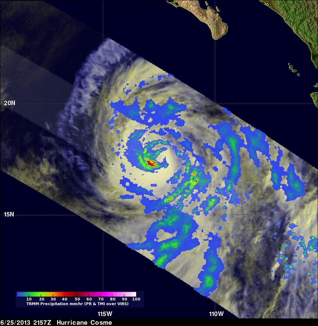
The TRMM satellite had a perfect view of hurricane Cosme when it was close to peak intensity. TRMM passed directly over head on June 25, at 2157 UTC (2:27 PM PDT). At that time hurricane Cosme was estimated to have winds of over 70kts (~80.5 mph). TRMM's Precipitation Radar (PR) saw very heavy rainfall in powerful storms on the southwest side of Cosme's eye.
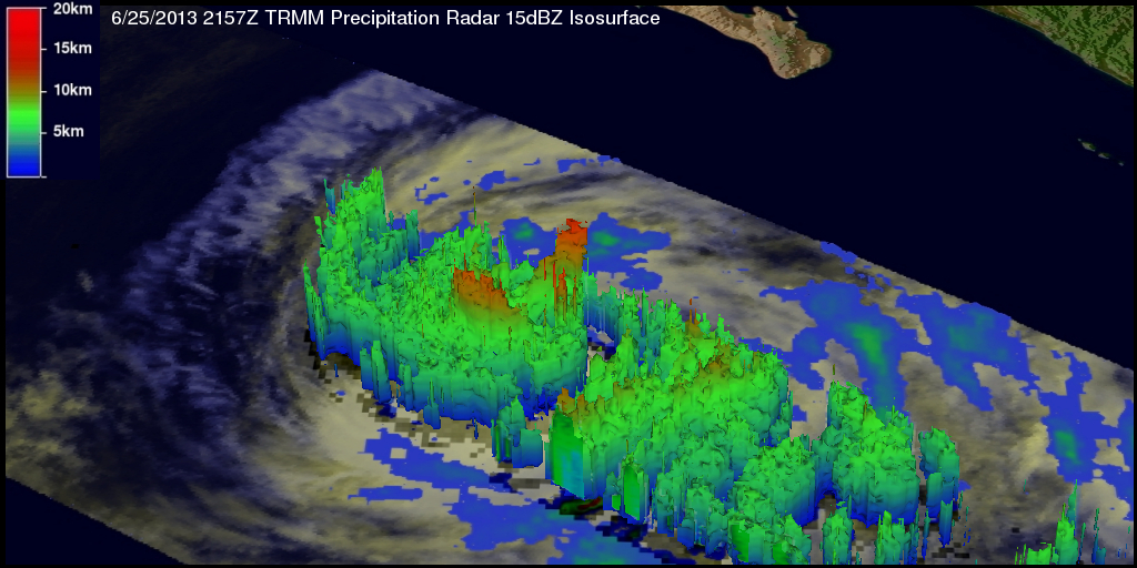
TRMM's 3-D Precipitation Radar (PR) data shows that Cosme had a ragged eye wall. The highest thunderstorm tops, reaching heights of about 13km (~8.1 miles), were found by TRMM PR to be located in the northeast side of the eye wall.
Click here to see a Quicktime simulated Flyby animation courtesy of TRMM PR.
Click here to see a Mpeg simulated Flyby animation courtesy of TRMM PR.
The National Hurricane Center (NHC) has forecast that Cosme will cross over cooler waters and gradually weaken to a remnant low within a few days.