
TRMM Sees Disorganized Aletta
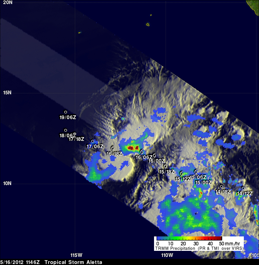
The TRMM satellite passed almost directly above tropical storm Aletta in the eastern Pacific Ocean on 16 March 2012 at 1146 UTC. Data from TRMM's Microwave Imager (TMI) and Precipitation Radar (PR) instruments were used in the rainfall analysis shown above. Aletta's past and future positions are shown overlaid in white. Aletta looks disorganized in this orbit but some very heavy thunderstorms, producing rainfall at a rate greater than 50mm/hr (~2 inches), were located near the storm's center.
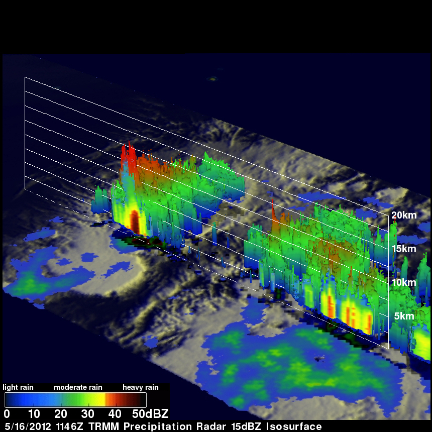
TRMM's Precipitation Radar (PR) found that some thunderstorms contained very heavy rainfall with a reflectivity value greater than 52dBZ being returned to the satellite. TRMM's PR data were also used to show Aletta's 3-D vertical structure in the image just above. This analysis shows that some of the heaviest thunderstorms within Aletta were reaching heights of about 16km (~9.9 miles). These towering thunderstorms can be a sign of intensification in tropical cyclones but dry air ingestion and wind shear in the future are expected to weaken Aletta.