
TRMM Sees Flooding Rainfall Along Gulf
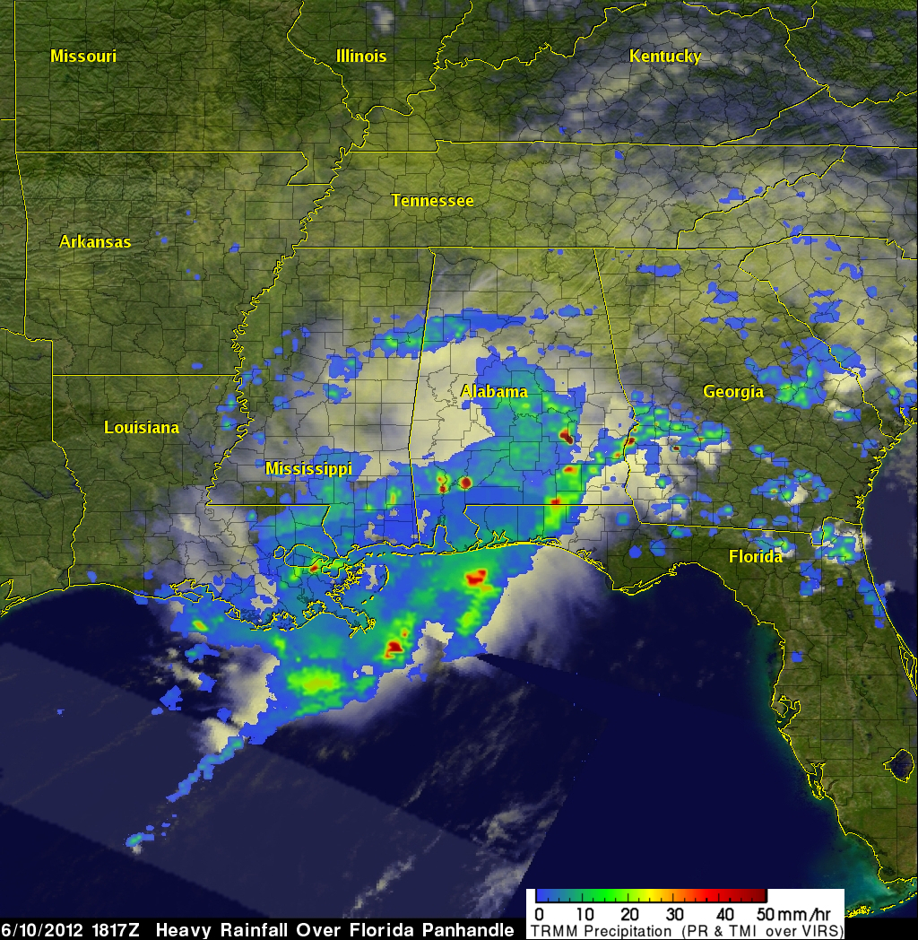

The states along the coast of the Gulf of Mexico experienced very heavy rainfall on Saturday June 9,2012 and Sunday June 10, 2012. The images above use TRMM satellite data collected when it flew over on Sunday June 10, 2012. Unusually heavy rainfall was occurring in states near the Gulf coast. Due to the path of TRMM's orbits it had good coverage with more than one orbit. The first orbit occurred at 1501 UTC (11:01 AM EDT). The second image shows a combination of more than one orbit with the later data being collected at about 1817 UTC (2:17 PM EDT). TRMM rainfall analyses from these orbits show that very heavy rain occurring from Louisiana through the Florida panhandle was moving very slowly. There were also three reports of tornadoes in Alabama on Sunday at about the same time as the first TRMM pass shown above.
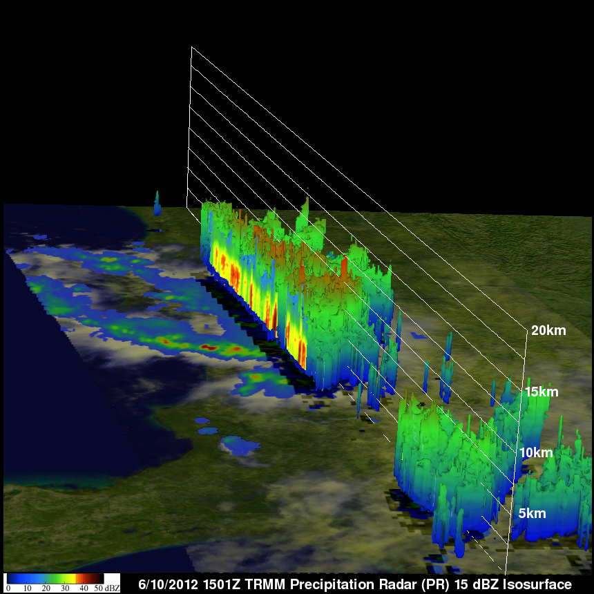
TRMM Precipitation Radar (PR) data were used to show a 3-D view of that stormy area (looking from the east). Some powerful thunderstorms near the reported tornadoes are shown reaching heights of about 12.5 km (~7.8 miles).