TRMM Sees Heavy Rain Over Taiwan
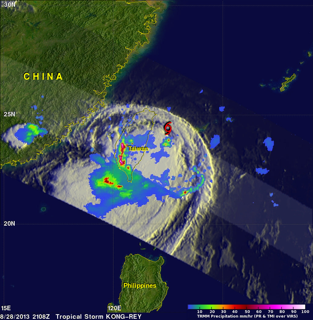
The TRMM satellite flew directly above western Taiwan on August 28, 2013 at 2108 UTC when tropical storm Kong-Rey was dropping enormous amounts of rain. Flooding from torrential rainfall with totals of over 500mm (~19.7 inches) have been reported in western Taiwan. This rainfall analysis from TRMM's Microwave Imager (TMI) and Precipitation Radar (PR) instruments revealed that precipitation was falling at a rate of over 205mm/hr (~8 inches) in intense bands of rain over southwestern Taiwan. Tropical storm Kong-Rey's location when TRMM flew over is shown with a red symbol.
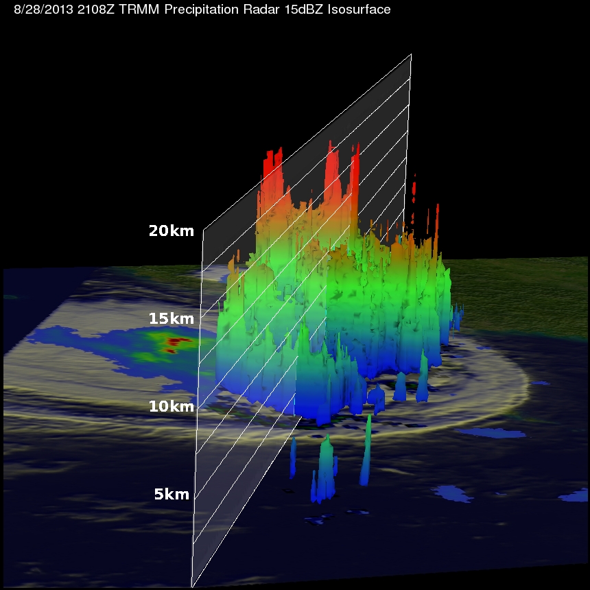
This TRMM orbit also showed that the tops of these powerful thunderstorms were often reaching heights above 16.5km (~10.3 miles). This 3-D view, from the east, shows the extremely high storms located on the western side of Taiwan.
Tropical storm Kong-Rey is now predicted to move to the north then northwest and affect all of Japan starting on August 31, 2013.