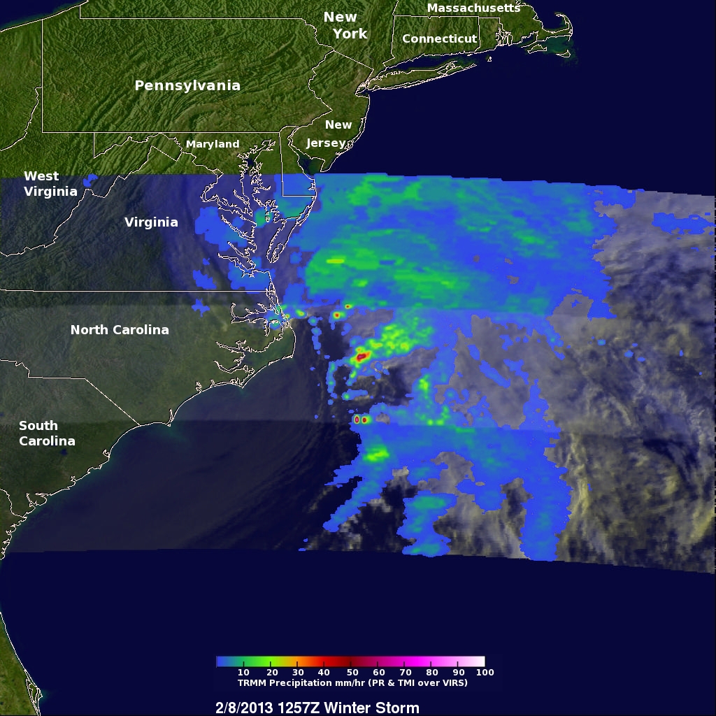
TRMM Sees Intensifying Winter Storm
At 1257 UTC (7:57 AM EST) this morning the TRMM satellite passed above a rapidly deepening low pressure center over coastal North Carolina. TRMM already saw stormy weather with this low when it was forming yesterday along the Gulf coast. Another area of low pressure moving from the Mid-West is predicted to merge with this storm and result in extreme blizzard conditions over the North-East. Near hurricane force winds and snowfall depths of over 610mm (~24 inches) are predicted in some areas from New York to Boston.
An analysis of rainfall from TRMM's Microwave Imager (TMI) and Precipitation Radar (PR) instruments is shown. The storm's precipitation shield was shown by TRMM to contain a very large area of light to moderate precipitation. TRMM's TMI found intense rainfall falling at a rate of over 29mm/hr (1.14 inches) in storms near North Carolina's coast. Snow depths are normally expected to be ten times the amount of liquid precipitation.
Image and Caption by Hal Pierce (SSAI/NASA GSFC)


