
TRMM Sees More Powerful Bejisa
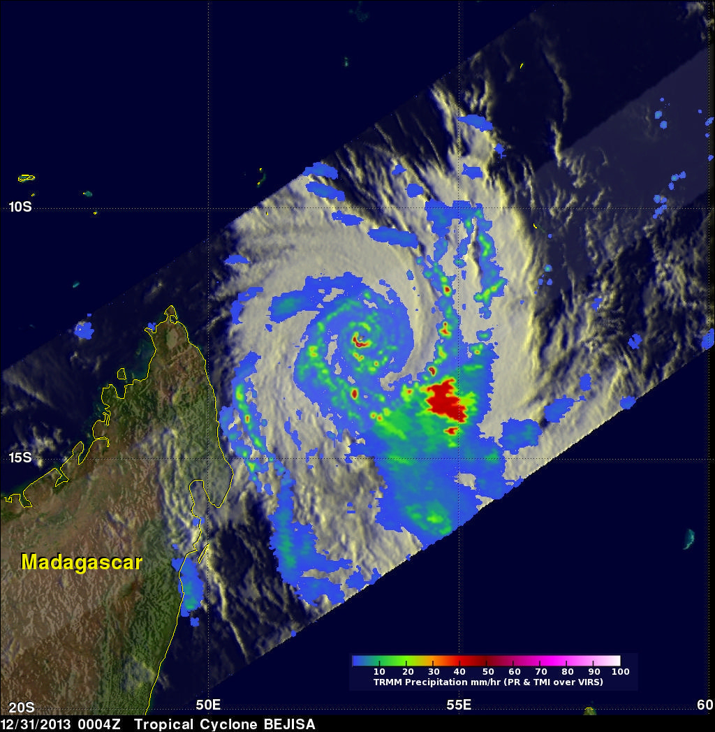
The TRMM satellite had an excellent view of intensifying tropical cyclone Bejisa northeast of Madagascar on December 31, 2013 at 0004 UTC. As expected, Bejisa became more powerful and had maximum sustained wind speeds estimated at 105 kts (~121 mph) when TRMM flew over. A rainfall analysis from TRMM's Microwave Imager (TMI) and Precipitation Radar (PR) instruments is shown overlaid on an enhanced infrared image from the Visible and InfraRed Scanner (VIRS). Extremely heavy rainfall in Bejisa's eye wall returned reflectivity values greater than 55dBZ to the Precipitation Radar (PR) instrument.
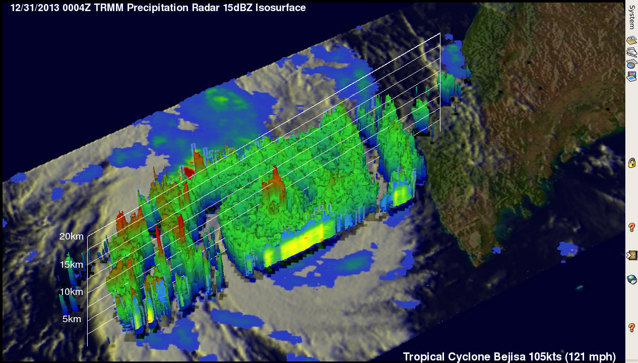
TRMM's Precipitation Radar reveals the 3-D vertical structure within tropical cyclone Bejisa in the image above. The heavy convective thunderstorms in Bejisa's eye wall reached heights above 13km (~8 miles). The tallest thunderstorms that were reaching heights above 16km (~9.9 miles), however, were shown by TRMM PR to be located in a feeder band well to the east of Bejisa's eye.
Click here to see a Low Resolution 640x360 simulated 3-D (Quicktime) flyby animation over category 3 tropical cyclone BEJISA using TRMM PR data.