
TRMM Sees South Pacific Tropical Cyclone 21P
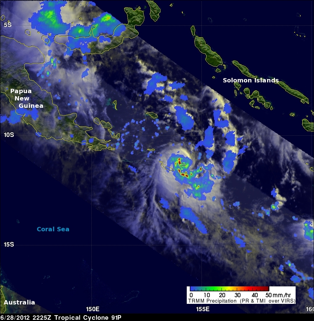
The South Pacific hurricane season normally ends in April but tropical cyclone 21P has developed in the South Pacific Ocean between Papua New Guinea and the Solomon Islands. The center of the tropical cyclone was directly beneath the TRMM satellite when it passed over on 28 June 2012 at 2225 UTC (~8:25 AM Local time). A rainfall analysis using data from TRMM's Microwave Imager (TMI) and Precipitation Radar (PR) instruments shows that the tropical cyclone, although small, was well organized and contained some intense convective storms dropping rainfall at a rate of over 50mm/hr (~2 inches).
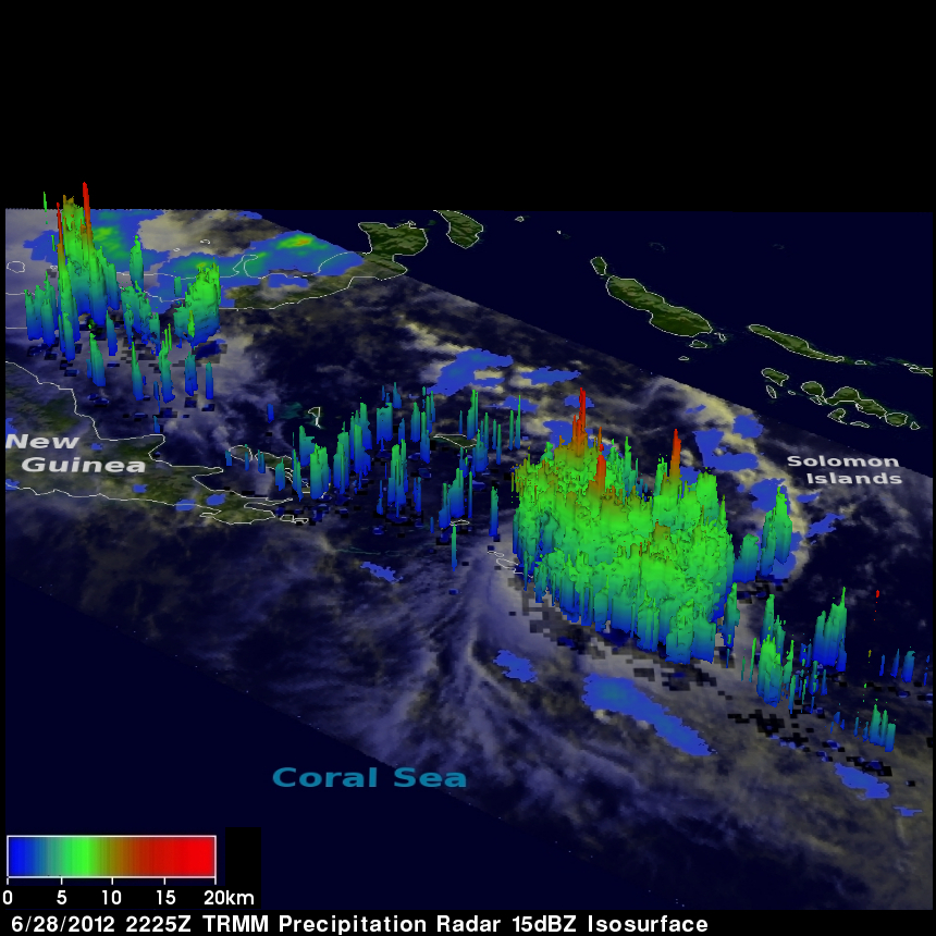
A 3-D view using TRMM's Precipitation Radar data shows that some of the storms around the tropical cyclone were reaching heights of at least 15km (~9.3 miles).