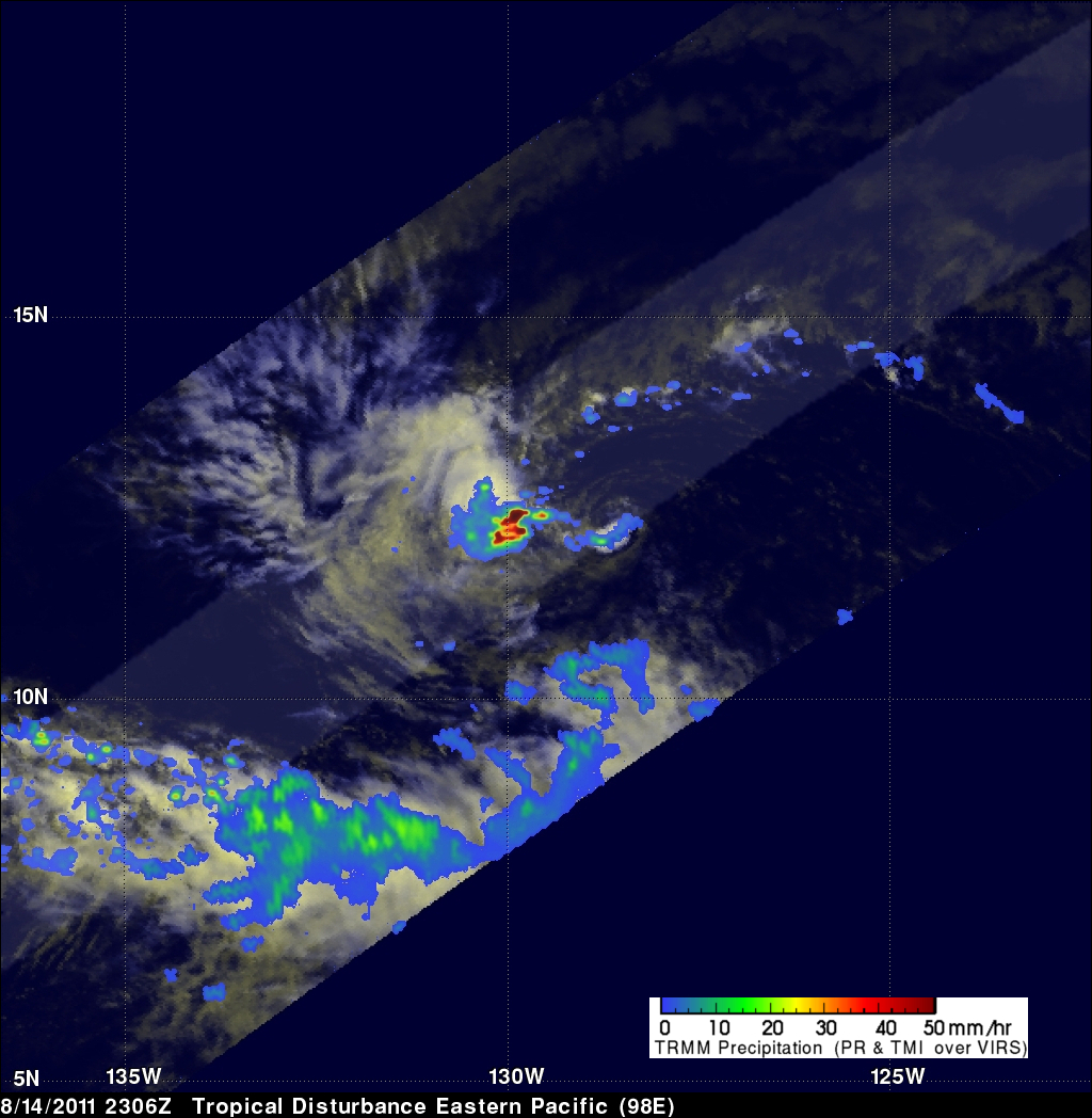
TRMM Sees Tropical Cyclone Forming
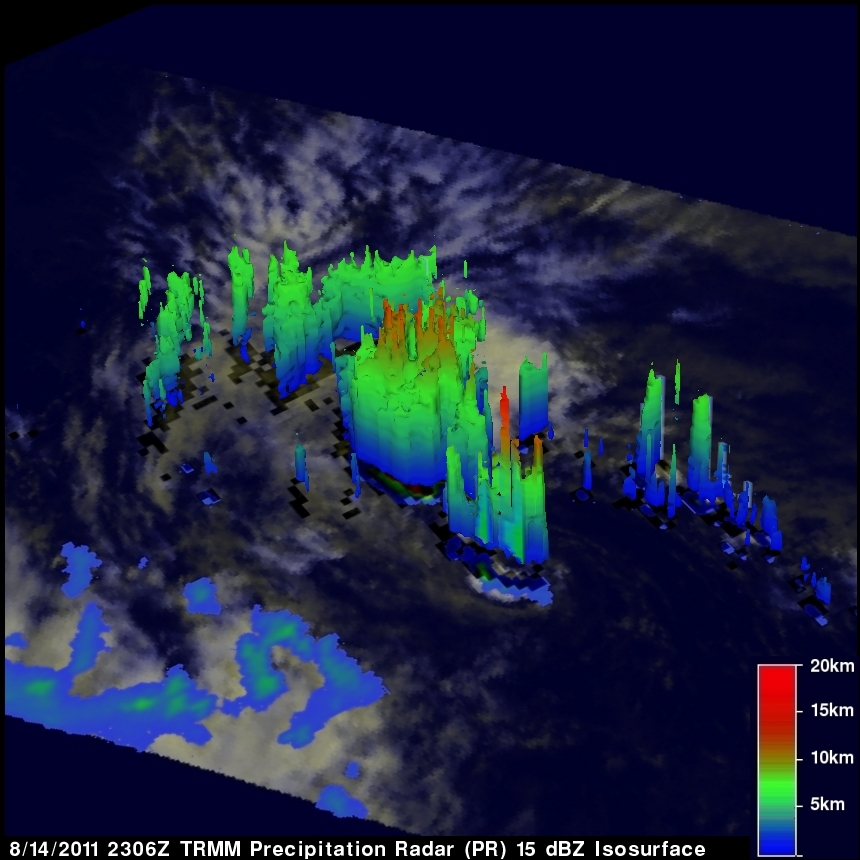
The National Hurricane Center (NHC) has given an area of disturbed weather in the eastern Pacific Ocean a high probability (70%) of becoming a tropical cyclone. The TRMM satellite flew over this disturbance, located about 2,680km (~1,665 miles) east-southeastof the Hawaiian Islands, on 14 August 2011 at 2306 UTC. TRMM's Precipitation Radar (PR) revealed that numerous heavy thunderstorms in an area west of the low pressure center were dropping rain at the rate of over 50mm/hr (~2 inches). TRMM's PR also showed that a few thunderstorm towers near the center of the developing tropical cyclone were reaching heights of about 13km (~8 miles).