
TRMM Sees Tropical Storm Heidi
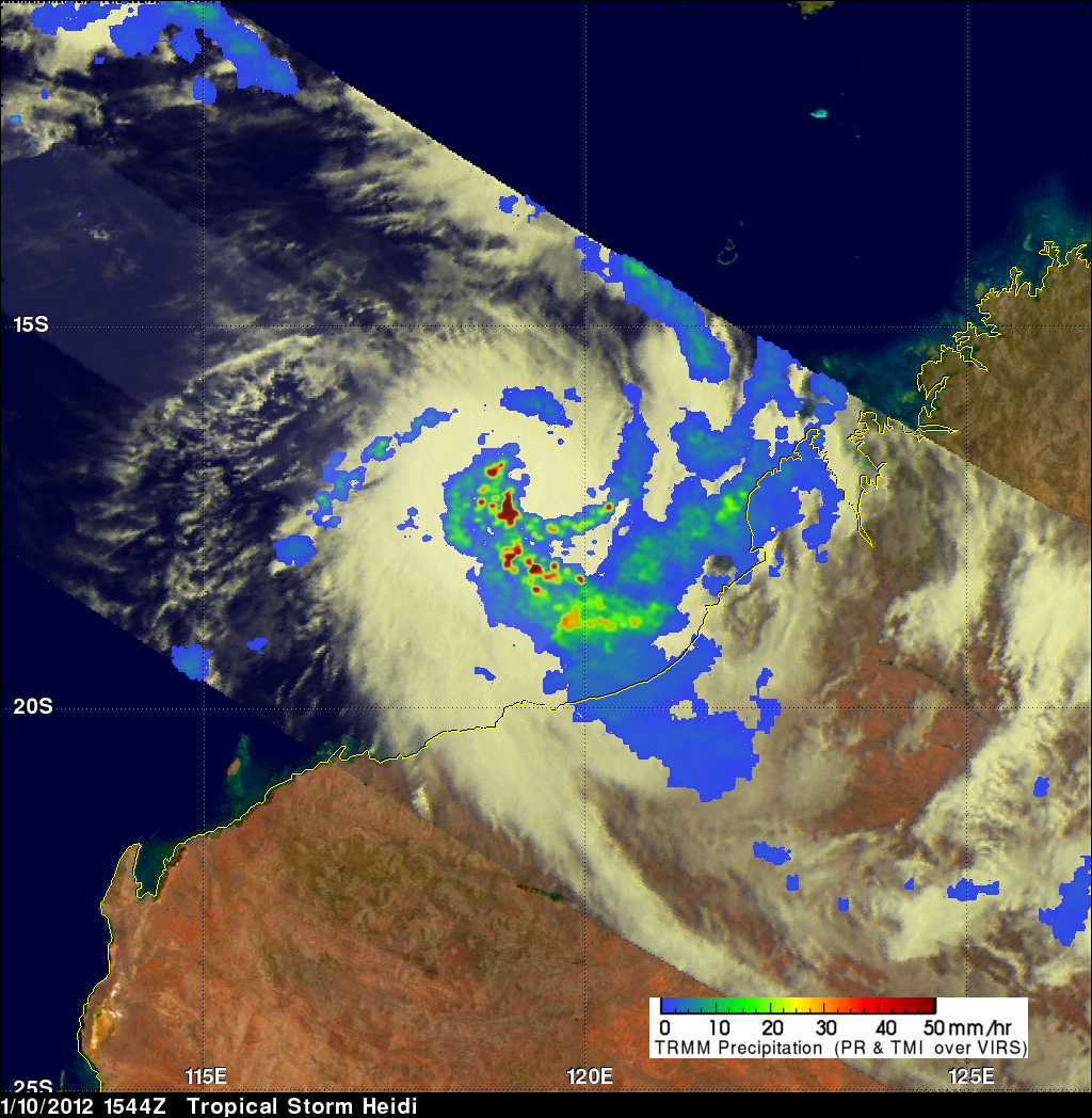
On 10 January 2012 at 1544 UTC the TRMM satellite passed above tropical storm Heidi as it was forming off the northwestern coast of Australia. Heidi is the first named tropical cyclone to hit Australia this season. An analysis of rainfall from TRMM Microwave Imager (TMI) and Precipitation Radar (PR) data is shown above. This analysis shows that Heidi was starting to get organized with bands of heavy convective rainfall spiraling toward the center of the storm. Heidi was dropping rainfall at a rate of over 50mm/hr (~2 inches) in some areas.
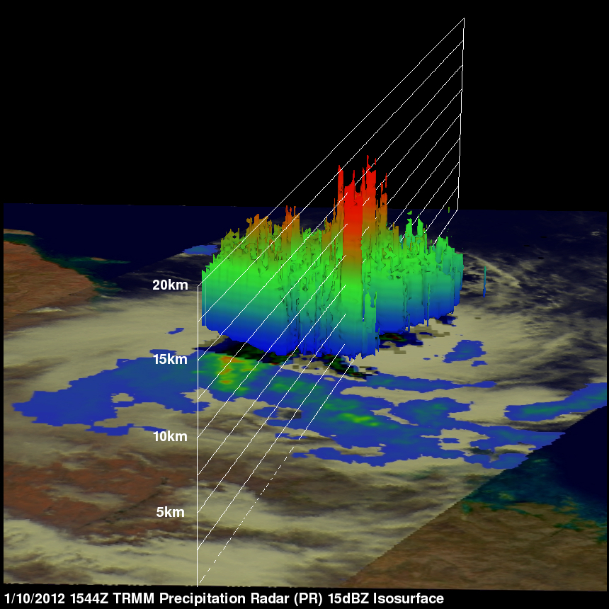
A 3-D image above was made from TRMM PR data. It shows that some storms within Heidi were reaching heights above 15km (9.3 miles).
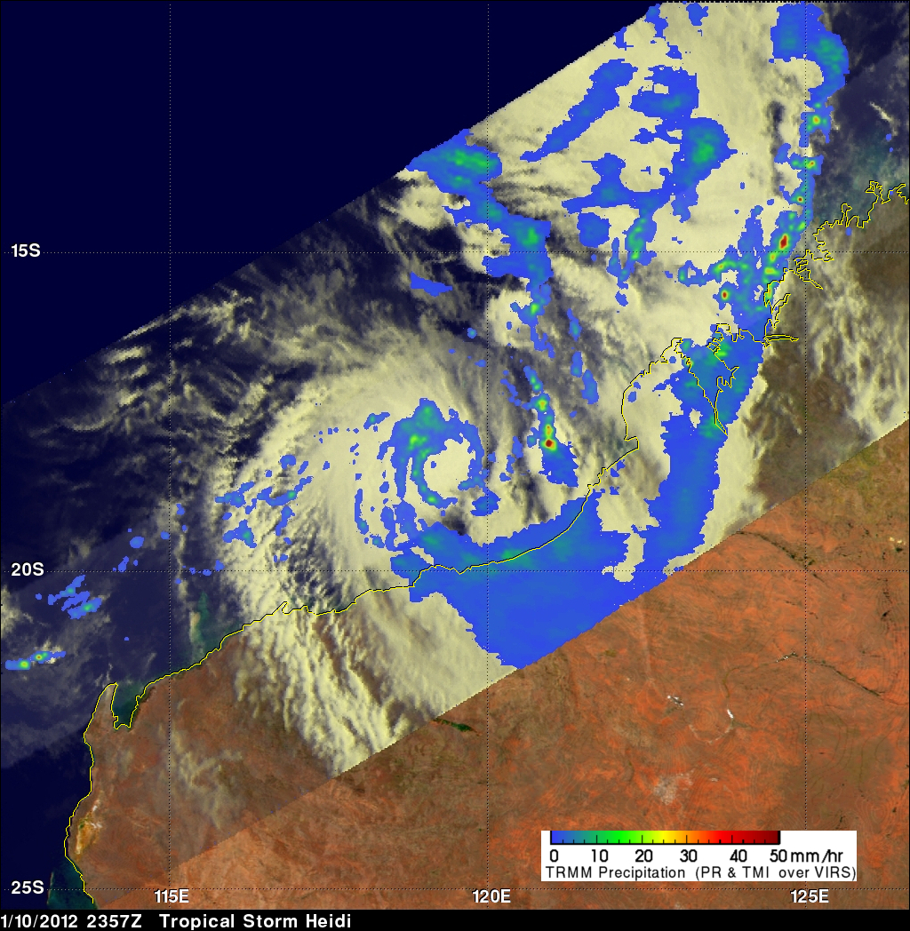
TRMM saw Heidi again on 10 January 2012 at 2357 UTC and collected data used in the image on the right. Rainfall data from TRMM PR data revealed that Heidi's location was defined by a rain band circling the center of the storm. This analysis also shows that very heavy rainfall from Heidi's outer bands was hitting the Australian coast.
Heidi is predicted to weaken to a tropical depression while moving inland over Northwestern Australia.