
TRMM Sees Tropical Storm Lorena
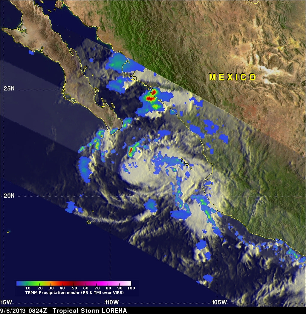
The development of tropical cyclones in the Atlantic Ocean basin has been very slow recently but tropical cyclones have formed in the Eastern Pacific Ocean at a near normal or greater than normal pace. Sixteen tropical cyclones per season usually form in the eastern Pacific and tropical storm Lorena is number fourteen. The TRMM satellite flew above this most recent Eastern Pacific tropical storm on September 6, 2013 at 0824 UTC.
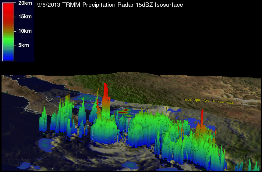
TRMM's Microwave Imager (TMI) and Precipitation Radar (PR) data show that Lorena did not contain large areas of precipitation. Those data do show that Lorena had one thunderstorm complex on the northwestern side of the tropical storm that was dropping rain at a rate of over 95mm/hr (~3.7 inches). The 3-D view derived from TRMM PR shows that tops of these thunderstorms reached heights above 15km (~9.3 miles).
Tropical storm Lorena is predicted to travel toward the northwest and dissipate over the southern Baha peninsula in the next 36 hours. Some moisture from Lorena's remnants may be transported to the southwestern United States next week.