
TRMM Sees Tropical Storm Lua's Formation
A tropical storm called LUA formed in the Indian Ocean off Australia's northwestern coast on 13 March 2012. This area of Australia is sparsely populated but LUA caused the shutdown of over one quarter of the country's crude oil production.
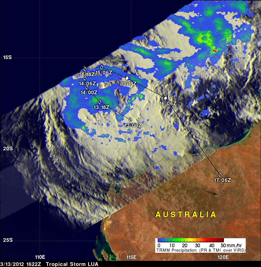
The TRMM satellite flew over this area on 13 March 2012 at 1622 UTC. A Rainfall analysis using TRMM's Microwave Imager (TMI) and Precipitation Radar (PR) instruments is shown overlaid on an enhanced infrared image from TRMM's Visible and InfraRed Scanner (VIRS). This analysis indicates that rainfall intensity was mainly in the moderate range of 20 to 30 mm/hr (~ .8 to 1.2 inches). The area covered by TRMM's Precipitation Radar (PR) did not include LUA's center of circulation but storm towers in feeder bands southwest and northeast of the storm reached to heights of almost 15 km (9.3 km).
LUA is predicted to circle back toward the northwestern coast of Australia and attain minimal hurricane force winds on 15 March 2012. LUA's predicted track with appropriate symbols is shown.