TRMM Sees Two Pacific Tropical Cyclones
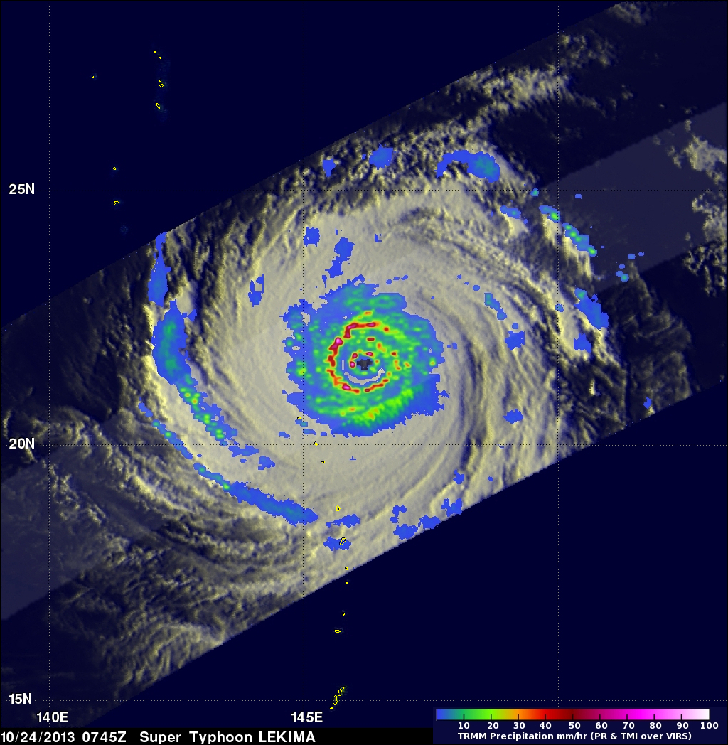
Tropical Storm Lekima
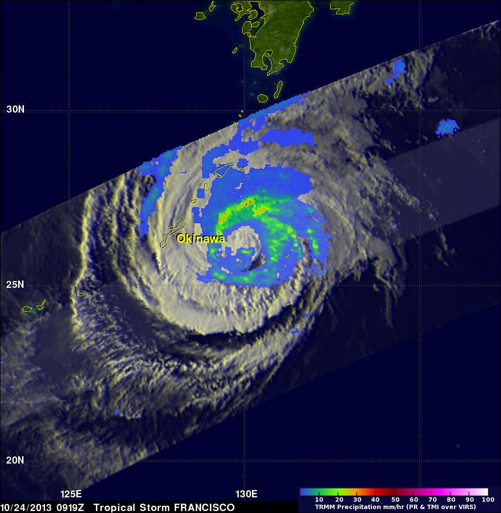
Tropical Storm Francisco
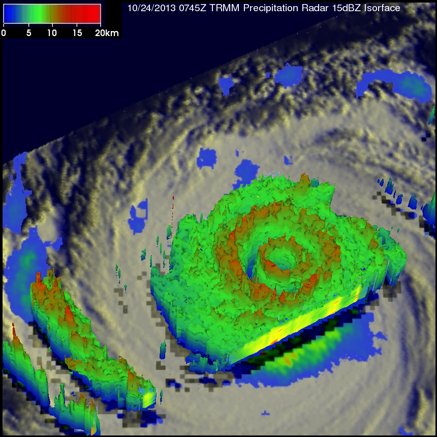
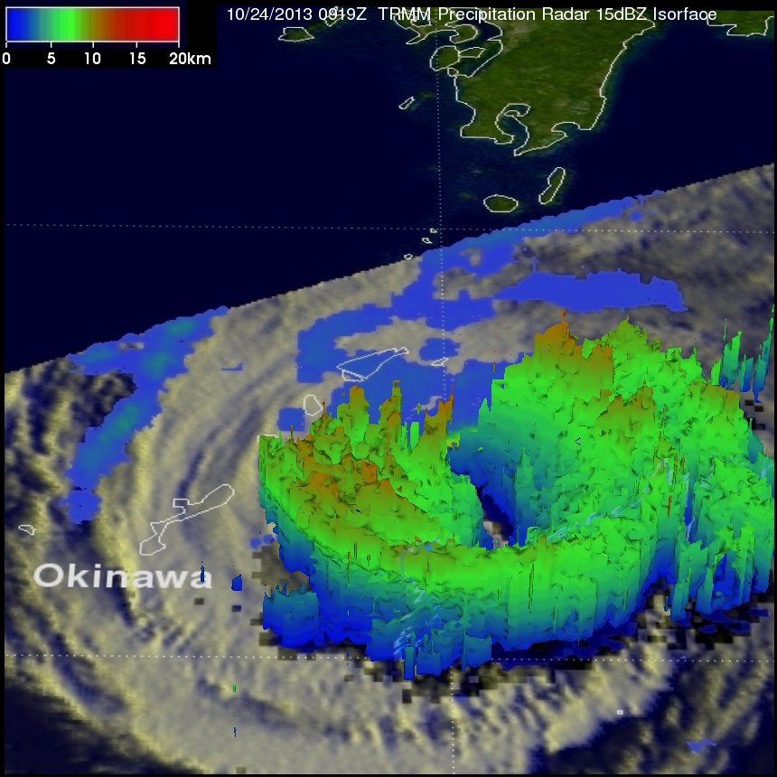
The TRMM satellite flew above the centers of two tropical cyclones in the western Pacific Ocean early this morning. The first orbit saw super typhoon LEKIMA at 0745 UTC and with the next orbit tropical storm FRANCISCO came into view at 0919 UTC. Lekima was located southeast of tropical storm Francisco over the open waters of the Pacific. Precipitation data from TRMM's Microwave Imager (TMI) and Precipitation Radar (PR) instuments are shown overlaid on infrared images from TRMM's Visible and InfraRed Scanner (VIRS). These rainfall analyses show the contrast between the two tropical cyclones. TRMM's Precipitation Radar (PR) data revealed that Lekima had a small well defined eye at the center of the super typhoon with another concentric outer replacement eye wall. Rain was falling at a rate of over 130mm/hr (~5.2 inches) in the powerful storms in Lekima's outer eye wall. Francisco was also a super typhoon on October 20, 2013 but had greatly weakened by the time of this latest TRMM pass. Francisco now had a very large area in the center of the storm that was rain free. Lekima was the fourth super typhoon in the western Pacific this year with wind speeds estimated to be over 130kts (~150 mph).
Tropical Storm Lekima
Tropical Storm Francisco
Radar reflectivity data from TRMM's Precipitation Radar (PR) instrument were used in the images shown above. The differences between super typhoon Lekima and tropical storm Francisco are made more obvious in these simulated 3-D views of the tropical cyclones vertical structure. Identical simulated 3-D "flybys" were made using TRMM PR data captured with these orbits.


