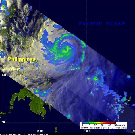
TRMM Sees Typhoon Songda
Typhoon Songda was east of the Philippines when the TRMM satellite had an early evening view on 25 May 2011 at 0903 UTC. Both TRMM's Microwave Imager (TMI) and Precipitation Radar (PR) instruments were used to provide the rainfall analysis shown above. TRMM's TMI had the best coverage of rainfall with Songda and showed well organized bands of moderate to heavy rainfall converging into the typhoon.
Songda was an intensifying category 3 typhoon, on the Saffir-Simpson scale, with wind speeds of over 105 kts (~121 mph) at that time. Songda is predicted to become a very powerful category 4 super typhoon with wind speeds peaking at 125 kts (~144 mph) as it passes to the northeast of the Philippines.


