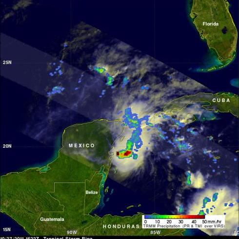
TRMM Sees A Weakened Rina
The TRMM satellite had a good daytime view of a much smaller tropical storm Rina on 27 October 2011 at 1522 UTC (10:22 AM CTD). Rina had decreased in size and strength due to vertical wind shear and dry air entrainment. Rainfall from TRMM's Microwave Imager (TMI) shows that heavy rainfall with the much diminished tropical cyclone was then only located off the coast of the Yucatan Peninsula. Click here to see a movie that fades from the visible image to the rainfall image.


