
TRMM Shows Typhoon Drenching Southern Japan
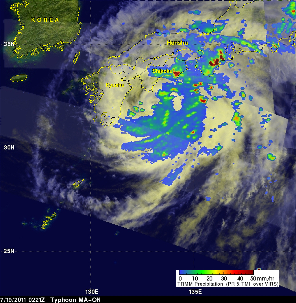
The TRMM satellite saw typhoon MA-ON on 18 July 2011 at 2306 UTC and again on 19 July 2011 at 0221 UTC. The rainfall analysis above used TRMM's Microwave Imager (TMI) and Precipitation Radar (PR) data from both orbits. It shows that bands of very heavy rainfall of over over 50 mm (~2 inches) were falling over both of the Japanese island of Shikoku and Honshu. At the time of the later TRMM orbit MA-ON's winds had weakened to about 67 kts (~77 mph) making it a category 1 typhoon on the Saffir/Simpson scale. MA-ON is expected to move toward the east-southeast and weaken as it continues to affect southern Japan for the next few days.
Click here to see earlier TRMM information about MA-ON's formation.