
TRMM Views Area Of Possible Tropical Cyclone Development
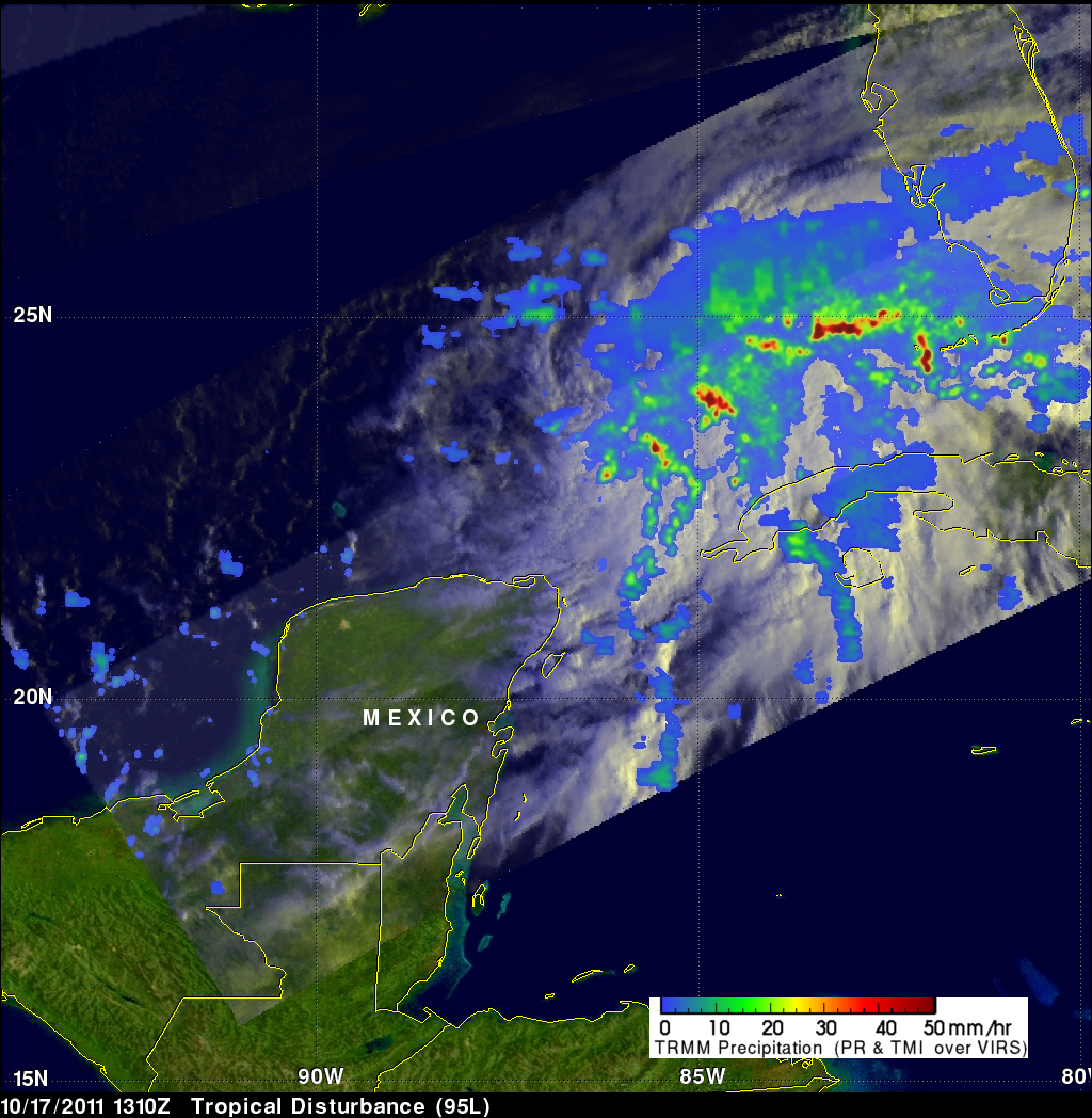
The TRMM satellite flew over an area of disturbed weather in the southeastern Gulf Of Mexico on 17 October 2011 at 1310 UTC (9:10 AM EDT). The National Hurricane Center (NHC) has given this area of low pressure a medium chance (40%) of becoming a tropical cyclone during the next 48 hours. A rainfall analysis from TRMM's Microwave Imager (TMI) and Precipitation Radar (PR) data shows that a large area of rainfall associated with this disturbance extends from the northern tip of Mexico's Yucatan Peninsula to the southwest coast of Florida. Several stormy areas within this disturbed weather are dropping rainfall at a rate greater than 50mm/hr (~2 inches).