Tropical Cyclone Alessia Soaks Northern Australia
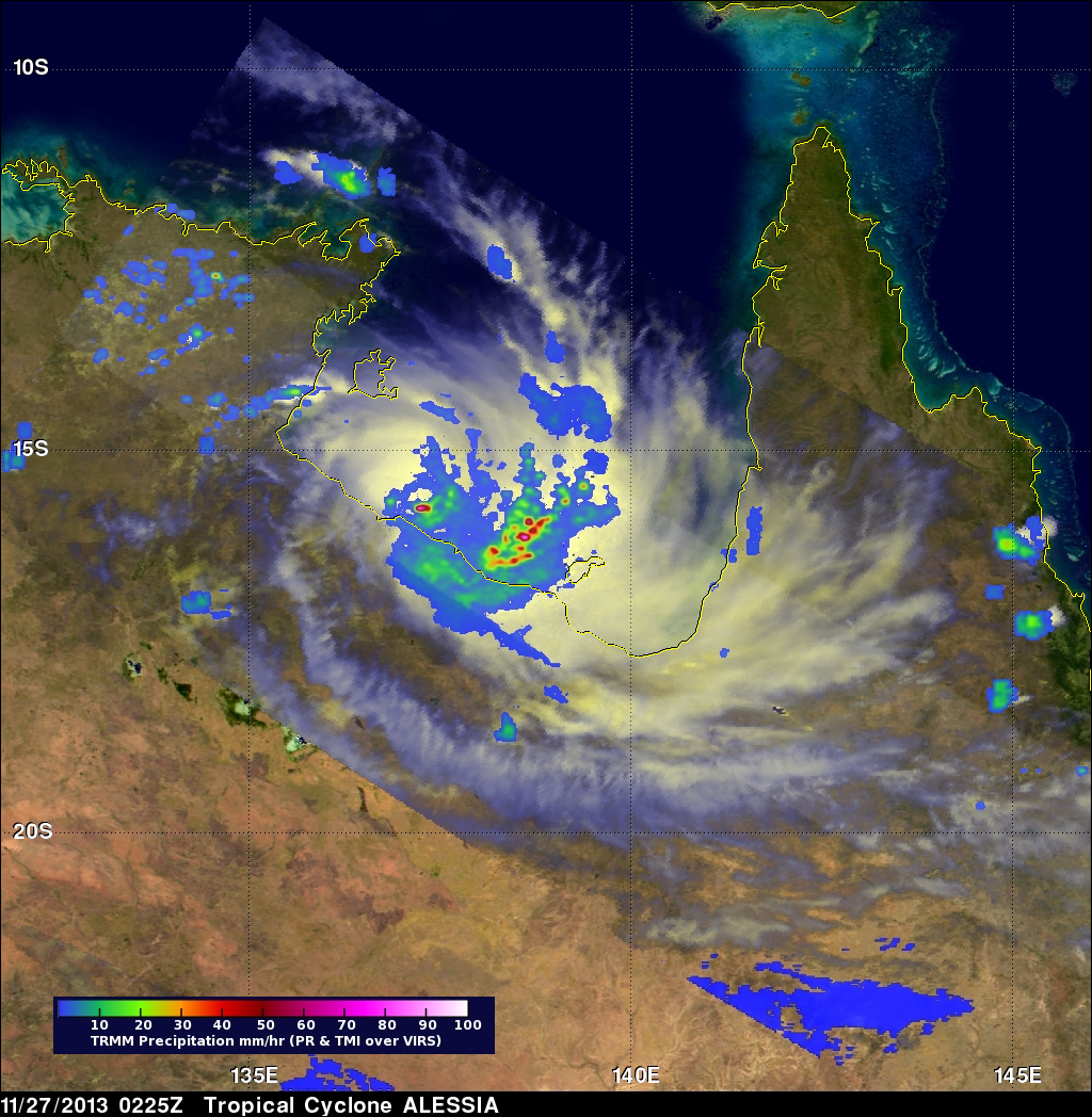
During the past weekend tropical cyclone ALESSIA weakened to a tropical low as it moved from the Timor Sea over Northern Australia. The warm waters of the Gulf Of Capentaria have helped revive ALESSIA to tropical storm intensity today. The image on the right shows TRMM satellite data collected on November 27, 2013 at 0225 UTC.
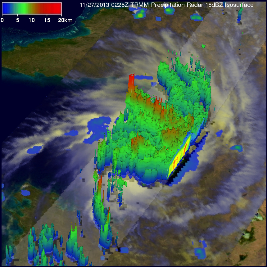
A 3-D perspective view (from the west) shows the tropical cyclone's vertical structure based on radar reflectivity data collected by TRMM's Precipitation Radar (PR) instrument. Thunderstorm towers are shown reaching heights above 16km (~9.92 miles) in a feeder band east of ALESSIA's center of circulation. However, TRMM PR found that the heaviest precipitation, falling at the rate of over 132.7mm/hr (~5.4 inches), was located in a small area near ALESSIA's center at -15.79S 137.25E.
In the next couple days tropical cyclone ALESSIA is predicted to move southward over Australia and weaken to a tropical depression.