Tropical Cyclone Bejisa Near Madagascar
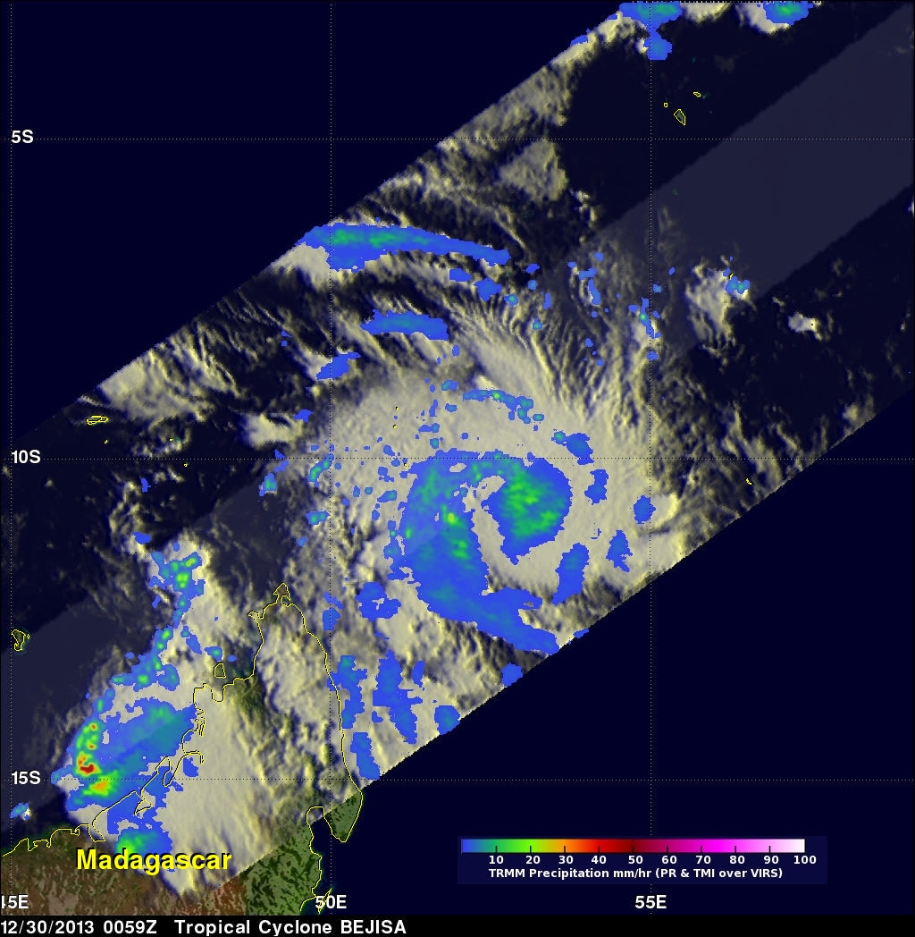
A tropical cyclone called Bejisa formed in the South Indian Ocean north-northeast of Madagascar on December 29, 2013 . The TRMM satellite flew over on December 30, 2013 at 0059 UTC. The image on the left shows a TRMM rainfall analysis for intensifying tropical cyclone Bejisa at that time when sustained winds were estimated to be greater than 60 kts (~69 mph). Data collected with TRMM's Microwave Imager (TMI) instrument provided better coverage of rainfall with this TRMM pass than the Precipitation Radar (PR) instrument that traveled to the northwest of Bejisa's center.
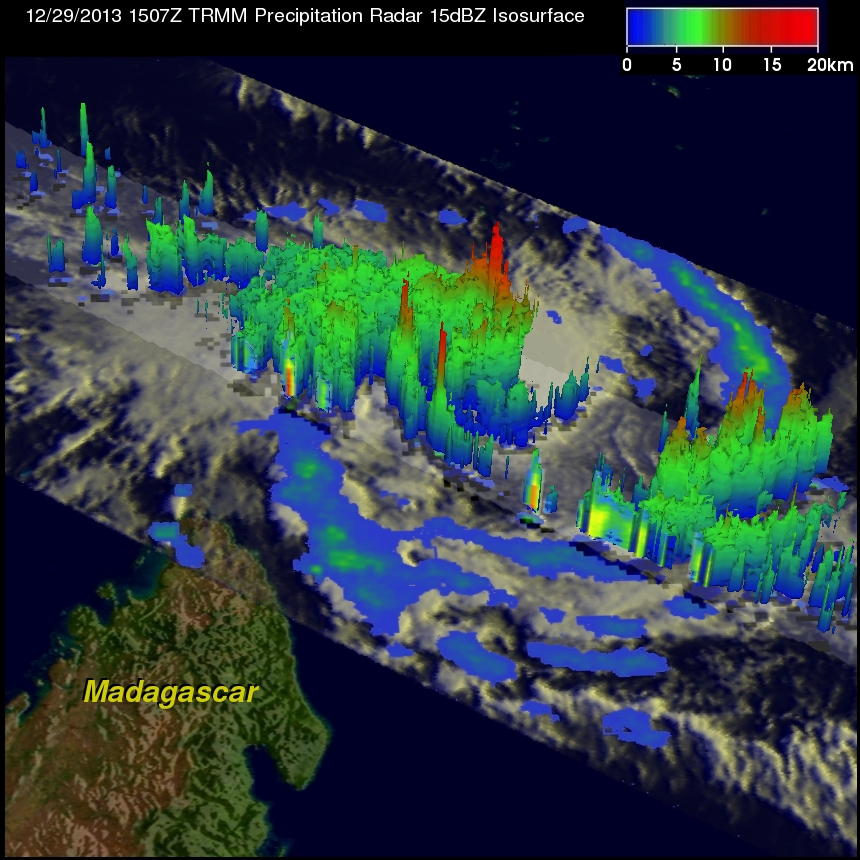
The image on the right shows a 3-D view of Bejisa using data collected by TRMM's Precipitation Radar (PR) yesterday on December 29, 2013 at 1507 UTC. TRMM PR found that many convective thunderstorms around Bejisa's center were reaching heights above 16.5 km (~10.2 miles).
Tropical cyclone Bejisa is predicted to continue intensifying and have winds of 90kts (~103 mph) while moving to the east of Madagascar.


