
Tropical Cyclone Bejisa Shown Menacing Reunion
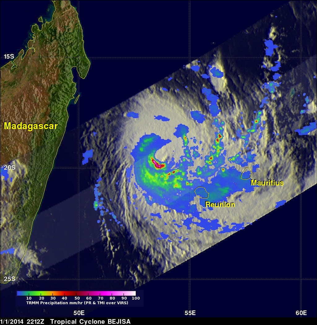
Extremely powerful tropical cyclone Bejisa has passed just to the west of the French island of Reunion in the southwest Indian Ocean. Bejisa's forward speed and very powerful winds within the tropical cyclone made this a dangerous location for Reunion. Bejisa was moving toward Reunion when the TRMM satellite had an excellent view on January 1, 2014 at 2212 UTC. Bejisa had sustained winds estimated to be over 105kts (~121 mph) at the time of this pass making it equivalent to a category three hurricane on the Saffir–Simpson hurricane wind scale. A rainfall analysis that used data from TRMM's Microwave Imager (TMI) and Precipitation Radar (PR) instruments is shown overlaid on an enhanced infrared image from the Visible and InfraRed Scanner (VIRS). Rainfall was found by TRMM PR to be falling at a rate of over 184 mm/hr (~7.2 inches) in some areas of the tropical cyclone. Maximum radar reflectivity values of over 53 dBZ were found in some very intense thunderstorms.
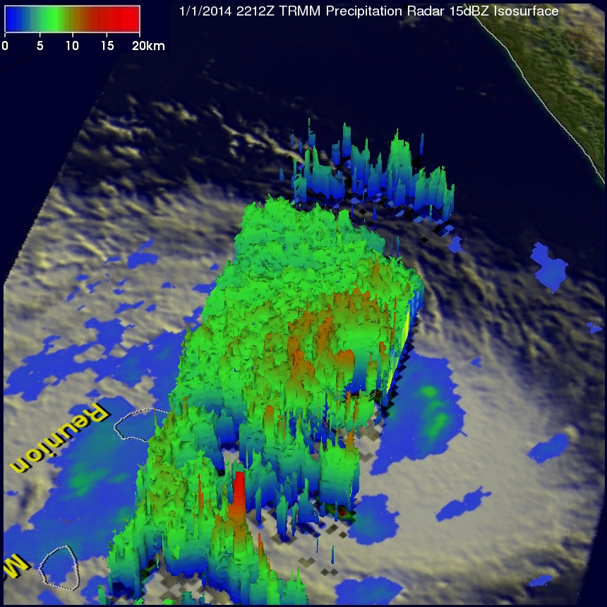
A 3-D view (from the northeast) using TRMM's Precipitation Radar (PR) data is shown above. Those TRMM data show that Bejisa's eye wall was well defined but was not complete on the northeastern side. Bejisa is predicted to gradually weaken while moving to the southwest away from Reunion in the next couple days.
Click here to see a Low Resolution 640x360 simulated 3-D (Quicktime) flyby animation over tropical cyclone BEJISA using TRMM PR data.