
Tropical Cyclone Formation
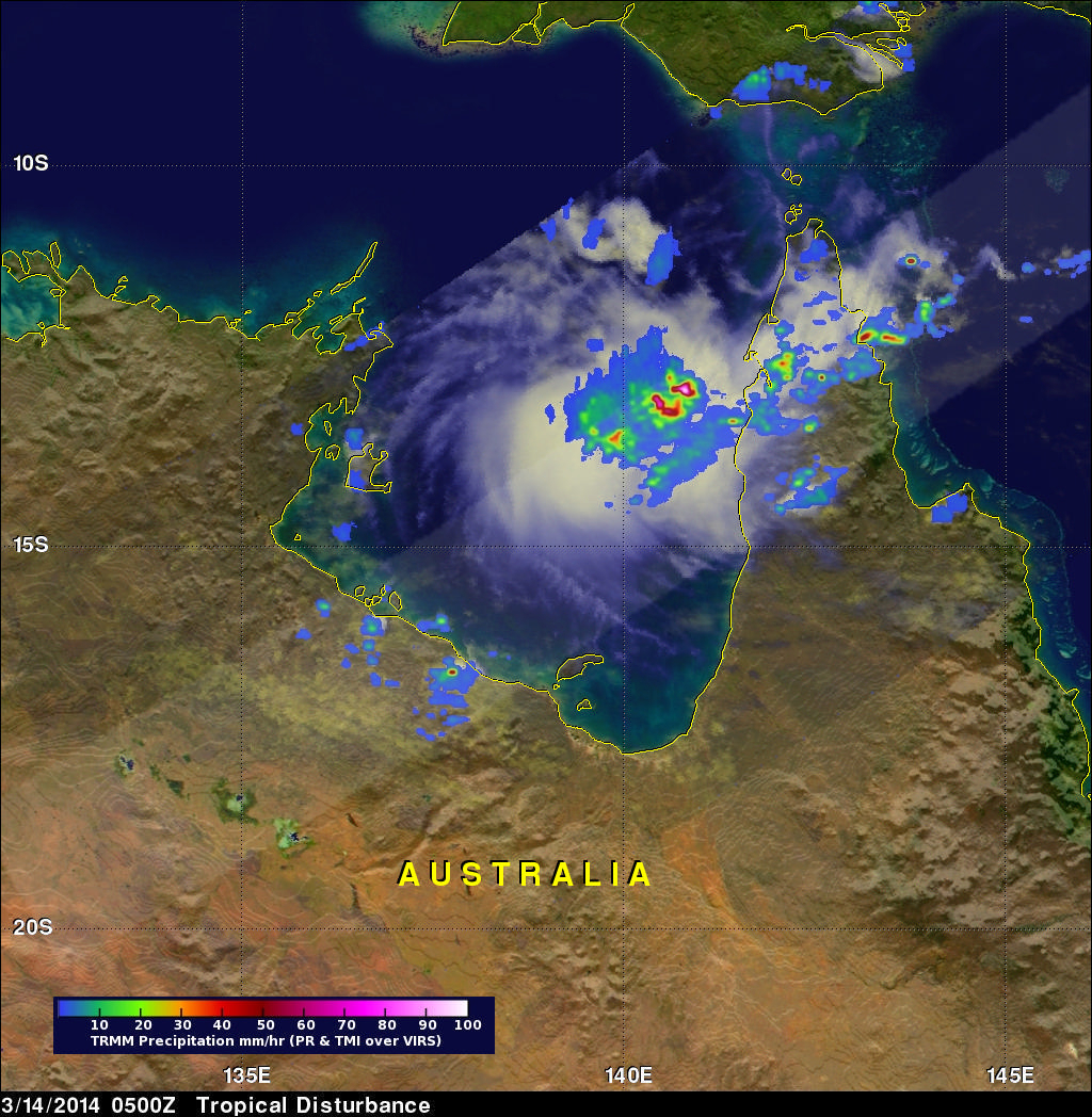
The TRMM satellite flew above northern Australia on March 14, 2014 at 0500 UTC capturing data used in the image on the right. Very strong convective storms in this area are the remnants of tropical cyclone GILLIAN and may signal a rebirth. TRMM's Precipitation Radar (PR) instrument found rain falling at the rate of over 116 mm/hr (~4.5 inches) in these powerful storms in the northeastern Gulf Of Carpentaria.
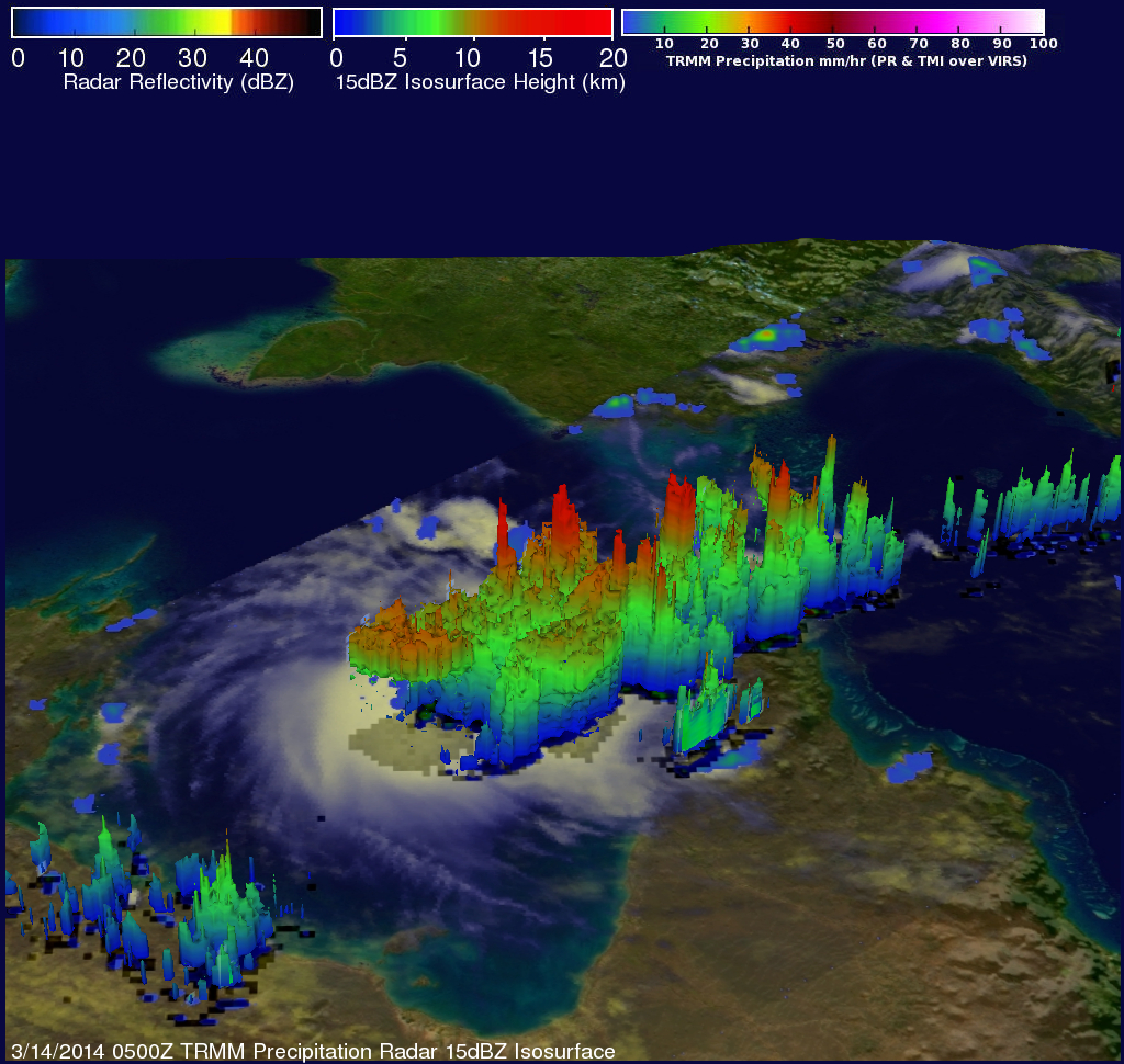
TRMM PR data were also used in this 3-D view of the strong convective storms in the northern Gulf Of Carpentaria. Some towering convective storms were found to be very energetic. Several tall storms were shown to reach altitudes greater than 16.75 km (10.4 miles). Some heavy rain within these storms was returning reflectivity values greater than 52dBZ to the satellite.
Click here to see a Low Resolution 640x360 simulated 3-D (Quicktime) flyby animation using TRMM PR data.
Click here to see a Low Resolution 640x360 simulated 3-D (MPEG) flyby animation using TRMM PR data.