
Tropical Cyclone Hellen
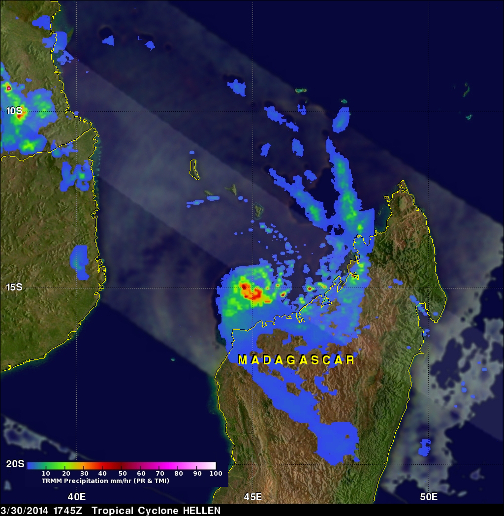
Tropical cyclone HELLEN formed in the Mozambique channel northwest of Madagascar on March 28, 2014. HELLEN became a very powerful tropical cyclone with peak sustained winds of 130kts (about 150 mph) on March 30, 2014. HELEN's eye came ashore in northwestern Madagascar On March 31, 2014 with winds predicted to be about 95kts (~109 mph). HELEN is now expected to gradually weaken over northwestern Madagascar while moving southwestward and be over the Mozambique Channel again on April 1, 2014. The TRMM satellite passed above HELLEN on March 30, 2014 at 1747UTC when the tropical cyclone was close to peak power.
The image on the right shows a rainfall analysis that was derived from TRMM's Microwave Imager (TMI) and Precipitation Radar (PR) data collected with that orbit. TRMM's Microwave Imager (TMI) had good coverage of HELEN's rainfall and found that rain was falling at a rate of over 44mm/hr (~1.7 inches) near the eye. Bands of moderate to heavy rain were shown moving over the northwestern coast of Madagascar.
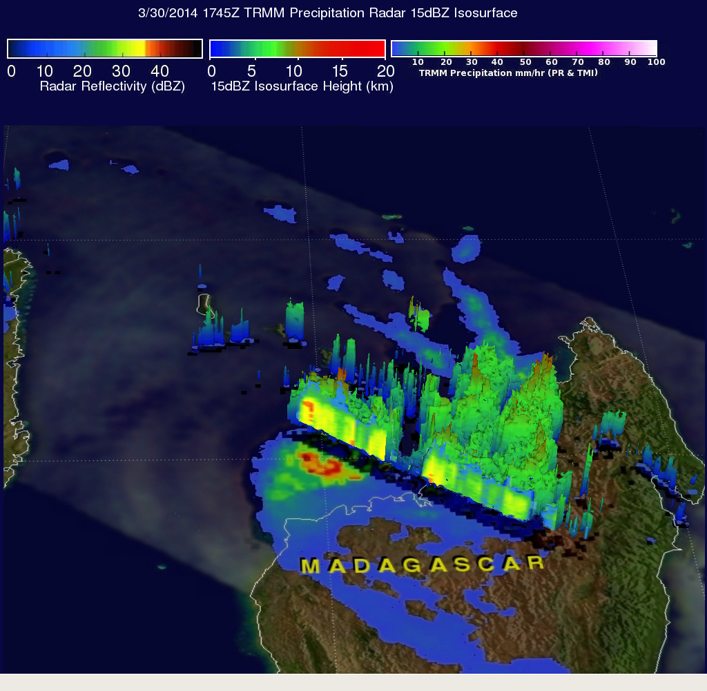
TRMM PR data were collected at the same time in a swath that passed near the northern edge of tropical cyclone HELLEN's eye wall. Those data were used in the simulated 3-D view of HELEN's precipitation shown above. These TRMM PR data show that some powerful storms in HELEN's eye wall were reaching heights of over 13 km(~8 miles).