
Tropical Cyclone Iggy
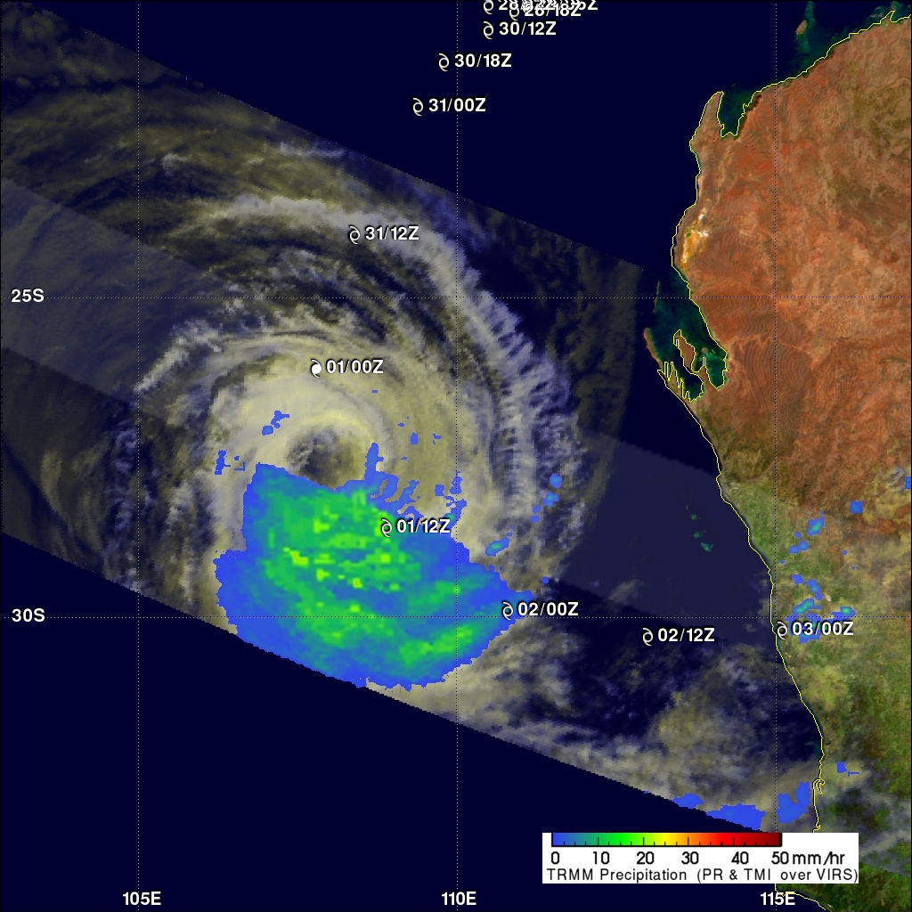
The TRMM satellite passed above tropical storm Iggy on 1 February 2012 at 0647 UTC as the storm was heading toward the coast of southwestern Australia. Iggy was briefly categorized as a category 1 tropical cyclone on the Saffir-Simpson scale but is predicted to be a weak tropical storm with winds of about 35kts (~40 mph) when it moves over the Australian coast. Iggy's past and forecast locations are shown with appropriate white tropical cyclone symbols on the image above. TRMM data revealed that Iggy had a large area of moderate to heavy rainfall south of the center of circulation. TRMM's Microwave Imager (TMI) and Precipitation Radar (PR) indicated that rainfall intensity was over 30mm/hr (~1.2 inches) in some locations.
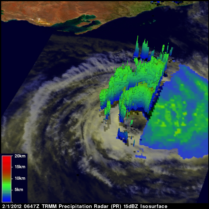
The image just above shows a 3-D view of Iggy using TRMM Precipitation Radar (PR) data. This view shows that a broken band of storms around Iggy's center of circulation were fairly shallow and weak with heights reaching to at most about 9km (~5.6 miles).