
Tropical Cyclone Ita Intensifies
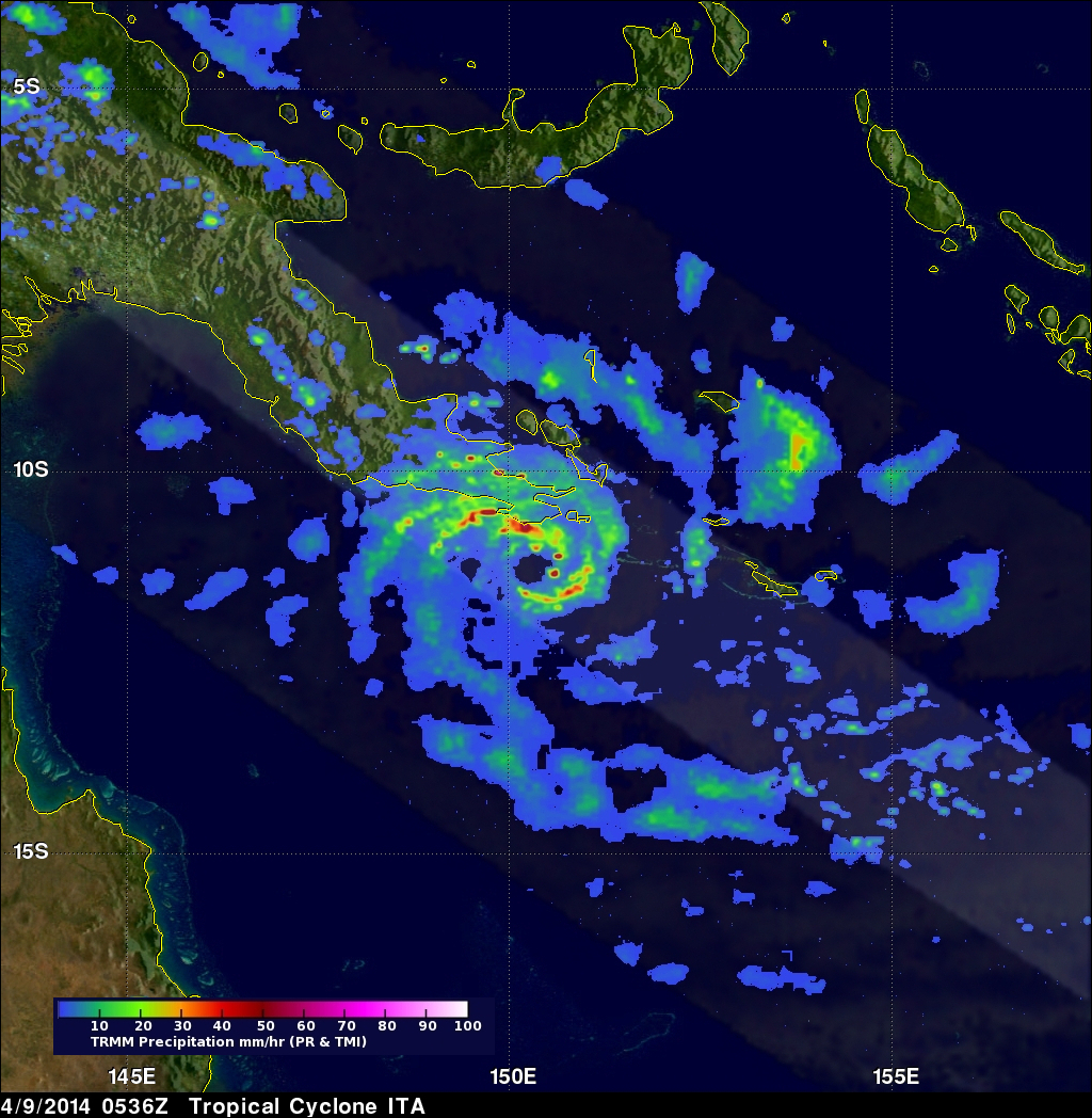
The TRMM satellite flew above intensifying tropical cyclone ITA in the Coral Sea near the southeastern tip of Papua New Guinea on April 9, 2014 at 0536 UTC. The tropical cyclone had developed a large but well defined eye and had sustained winds estimated at 65kts (about 75mph). Rainfall derived from TRMM's Microwave Imager (TMI) and Precipitation Radar (PR) data was used in the analysis shown here.

TRMM PR data unveiled rain falling at a rate of over 99mm/hr (about 3.9 inches) within ITA's feeder bands over the coast of southeastern Papua New Guinea. TRMM PR found that tall thunderstorms in ITA's eye wall were reaching heights of over 16km (about 9.9 miles) and were returning radar reflectivity values of over 57dBZ to the satellite. Tropical cyclone ITA is predicted to become even more powerful as it heads toward the southwest. In the next few days ITA is predicted to have winds of 105kts (about 121.8 mph) as it travels over the Coral Sea toward northeastern Australia.
Click here to see a Low Resolution 640x360 simulated 3-D (Quicktime) flyby animation using TRMM PR data.
Click here to see a Low Resolution 640x360 simulated 3-D (MPEG) flyby animation using TRMM PR data.