Tropical Cyclone Lehar In The Bay Of Bengal
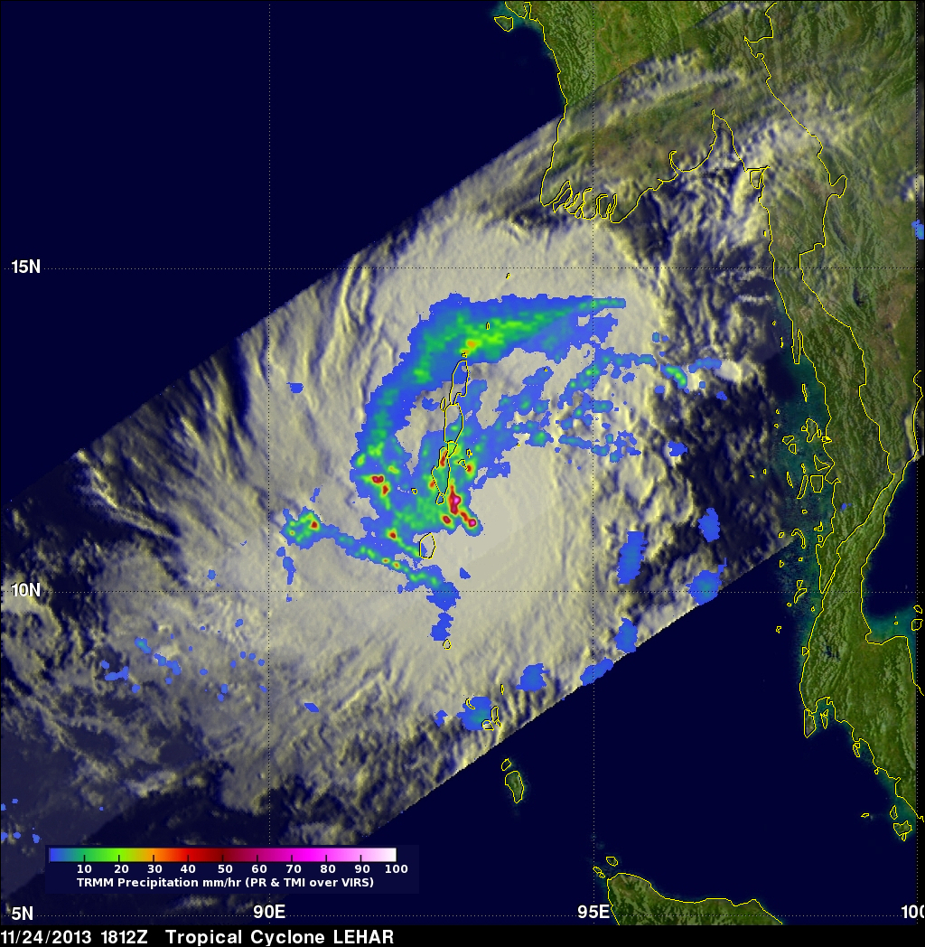
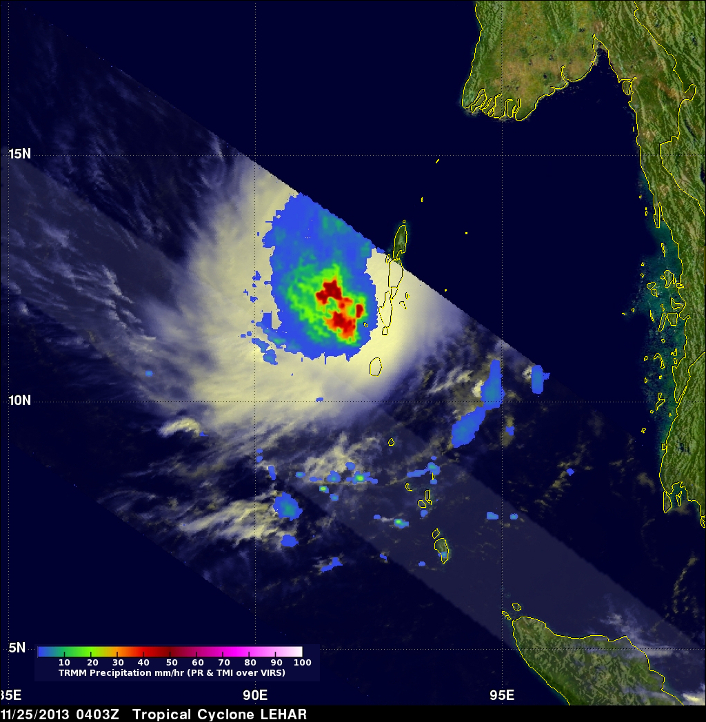
Today tropical cyclone LEHAR's estimated sustained wind speeds reached 65kts (~75 mph). The most powerful tropical cyclone in the Bay Of Bengal this year was deadly tropical cyclone PHAILIN that moved through the area in October with wind speeds of 140kts (~161 mph). This means that LEHAR is the second most powerful tropical cyclone to form in the Bay Of Bengal this year. The TRMM satellite collected data used in the image on the left when the TRMM satellite passed above LEHAR on November 24, 2013 at 1812 UTC. At that time LEHAR was intensifying with tropical storm force winds estimated to be over 55kts (~63 mph). The TRMM satellite found that LEHAR was much better organized, with a large area of moderate to heavy rainfall around the center, when TRMM flew over again on November 25, 2013 at 0403 UTC. Tropical cyclone LEHAR is predicted by the Joint Typhoon Warning Center (JTWC) to move toward the west-northwest and attain sustained wind speeds of 100kts (115 mph) when threatening the east-central coast of India in about 48 hours.
TRMM's Precipitation Radar (PR) instrument found a small number of convective thunderstorm towers reaching heights of about 5km (~9.3 miles) near LEHAR's center on November 24, 2013.