
Tropical Cyclone Mahasen Moving Into The bay Of Bengal
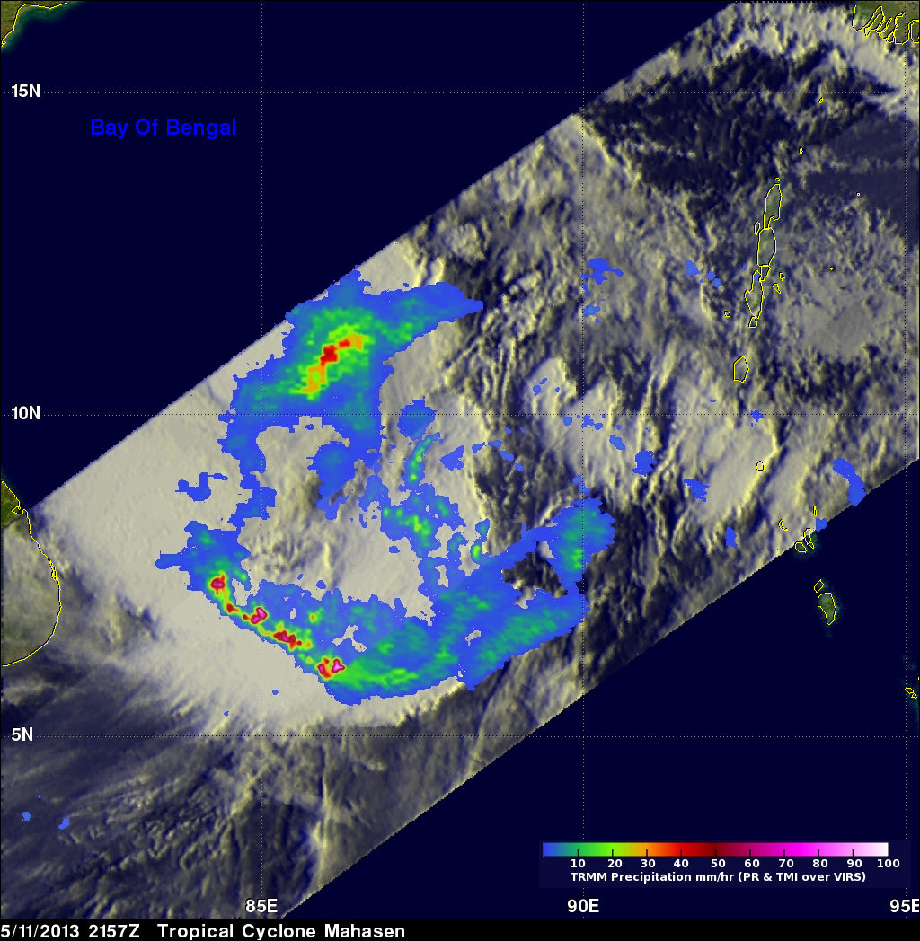
The TRMM satellite again flew almost directly above intensifying tropical cyclone Mahasen (01B) on May 11, 2013 at 2157 UTC. Rainfall data from TRMM's Microwave Imager (TMI) and Precipitation Radar (PR) instruments are shown overlaid on an infrared image from the Visible and InfraRed Scanner (VIRS). TRMM PR data found that the heaviest rainfall was falling at a rate of over 142 mm/hr (~5.6 inches) in a band of powerful storms well to the southwest of Mahasen's center. At the time of this TRMM pass Mahasen's winds were estimated to be about 50kts (~58 mph). Mahasen's winds are predicted to increase to hurricane force while the tropical cyclone moves further northward into the Bay of Bengal.