
Tropical Cyclone Rusty Heading For Australia
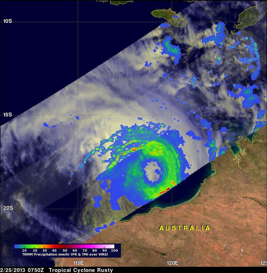
A tropical cyclone called Rusty developed in the Indian Ocean north of north-western Australia's coast on February 24, 2013. The TRMM satellite viewed the intensifying tropical cyclone when it flew over on February 25, 2013 at 0750 UTC. A rainfall analysis from TRMM's Microwave Imager (TMI) and Precipitation Radar (PR) with that orbit is shown overlaid on a visible/infrared image from TRMM's Visible and InfraRed Scanner (VIRS). This analysis showed that Rusty had an extensive area of rainfall surrounding Rusty's very large eye. TRMM PR and TMI instruments found that rain within wide bands of intense rain was falling at a rate of over 50mm/hr (~2 inches).
By February 26, 2013 tropical cyclone Rusty is predicted to intensify to a category three tropical cyclone on the Saffir-Simpson scale with winds of 100kts (~115 mph). Rusty's eye is then predicted to to slam into the coast northeast of Port Hedland, Australia.
Image and Caption by Hal Pierce (SSAI/NASA GSFC)