Tropical Cyclone Sandra Brushing New Caledonia
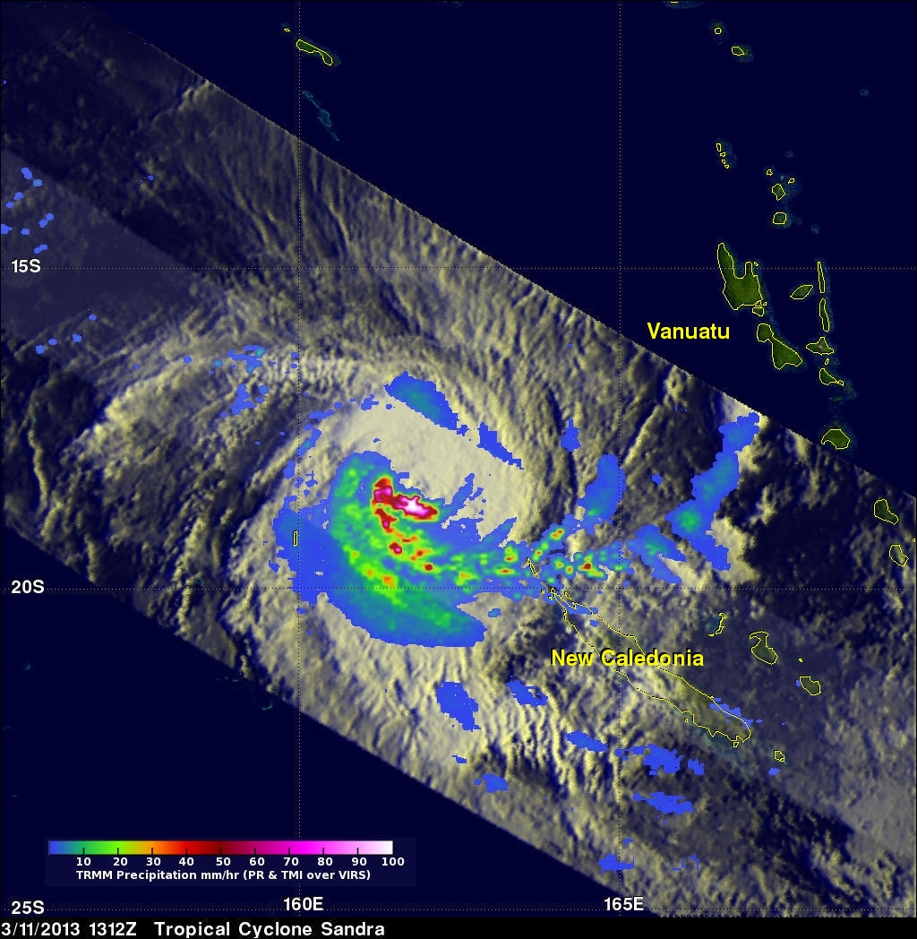
On March 11, 2013 the TRMM satellite twice flew above weakening tropical cyclone Sandra as it was passing to the west of New Caledonia in the southern Pacific Ocean. TRMM's Precipitation Radar (PR) had a very good view of Sandra as it passed directly above the tropical cyclone on March 11, 2013 at 1312 UTC. TRMM PR measured rainfall at the extreme rate of over 206 mm/hr (~8 inches) in an area southwest of Sandra's eye. Those TRMM PR data also showed that very little rain was occurring north of the weakening tropical cyclone's eye. Click here to see a simulated Flyby over Sandra using 3-D TRMM PR data from this TRMM pass.
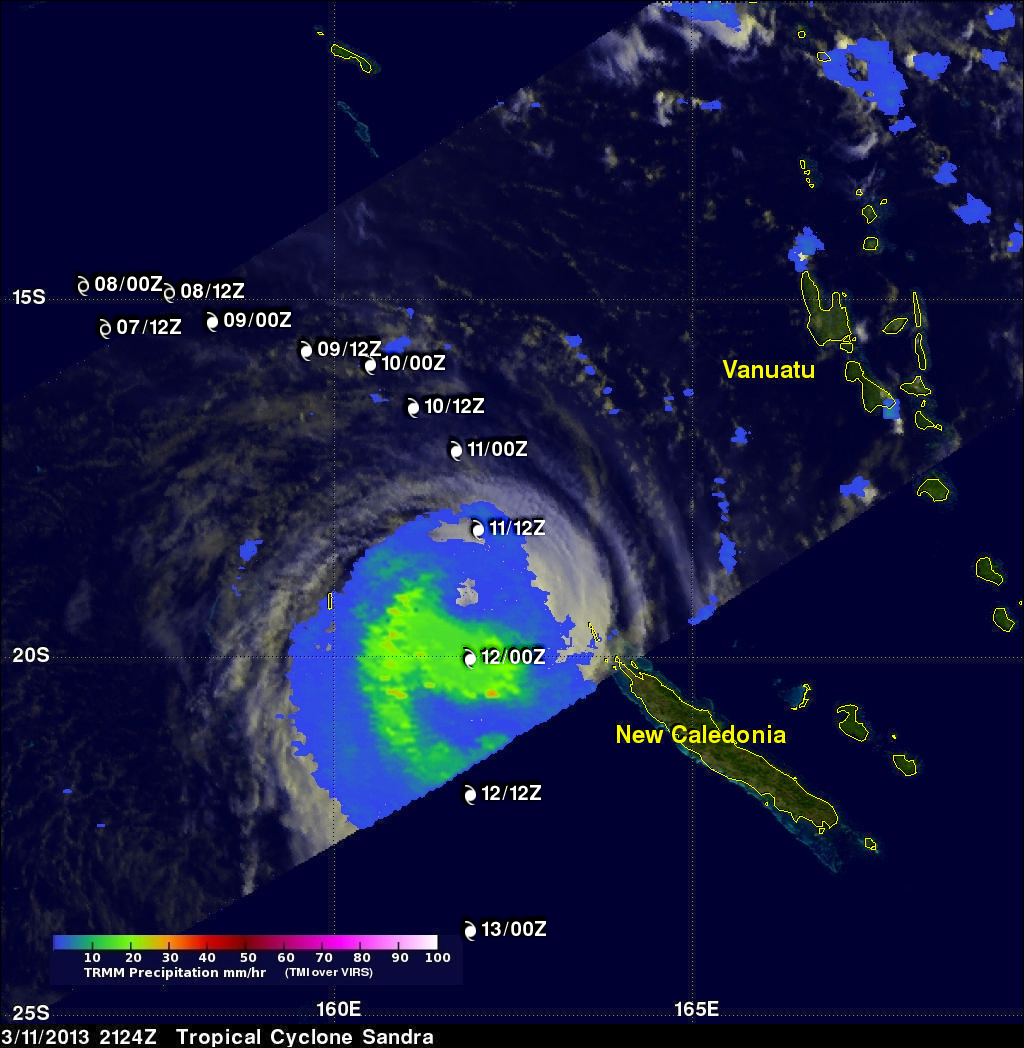
TRMM's Microwave Imager (TMI) data were used in the next image to show rainfall near Sandra again on March 11, 2013 at 2124 UTC. This TRMM pass showed that New Caledonia was escaping the heaviest precipitation that was occurring as Sandra was moving past. Sandra's previous and forecast locations are shown overlaid in white on this rainfall analysis.