Tropical Storm Adrian Seen Forming
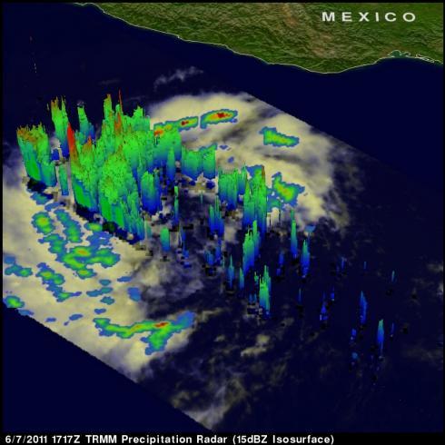
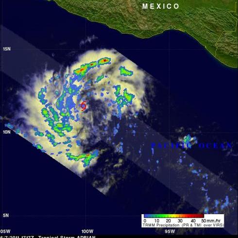
Tropical Depression ONE-E was well on it's way to becoming tropical storm ADRIAN when the TRMM satellite flew over again on 7 June 2011 at 1717 UTC. Rainfall data from TRMM's Microwave Imager (TMI) and Precipitation Radar (PR) show that bands of rainfall were starting to get organized. A red tropical storm symbol shows the location of the future storm's center of circulation. TRMM's PR showed thunderstorm towers as high as 15 km (~9.3 miles) in rain bands west of ADRIAN's center.


