Tropical Storm Aletta Forms
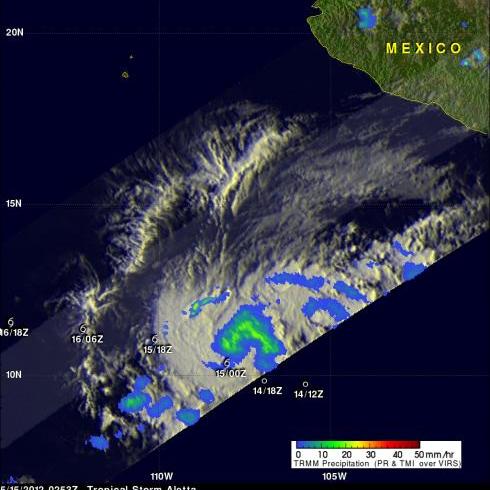
The eastern Pacific hurricane season starts today. Just slightly ahead of schedule tropical storm Aletta formed yesterday well to the southwest of the Mexican coast. The image above uses data captured when the TRMM satellite passed above Aletta on 15 May 2012 at 0253 UTC. TRMM's Microwave Imager (TMI) instrument had a good look at the newly formed storm and showed that Aletta had a large area of light to moderate rainfall north of the storm's center of circulation. The TMI rainfall analysis is shown overlaid on an enhanced infrared image from TRMM's Visible and InfraRed Scanner (VIRS) instrument.
Aletta's past and predicted locations with appropriate symbols are shown in white. The tropical storm is expected to intensify slightly and have it's greatest wind speeds of 45 knots (~52 mph) on May 16, 2012. Aletta is then forecast to continue moving harmlessly toward the west-northwest over open water and dissipate to a remnant low on May 19, 2012.


