Tropical Storm Beryl Brings Some Much Needed Drought Relief to Southeast US
Tropical Storm Beryl was actually a welcome sight in parts of the Southeast. Tropical cyclones are not always bad news. Sometimes they can be quite beneficial, especially when it comes to relieving drought conditions. Tropical Storm Beryl made landfall just after midnight (local time) on the night of 27 May 2012 near Jacksonville Beach, Florida as a strong tropical storm with sustained winds of 70 mph, making it the strongest tropical cyclone to make landfall in the US before the official June 1st start of the Atlantic hurricane season. Prior to the arrival of Beryl, many parts of the Southeast were experiencing severe drought conditions. Parts of north Florida, from around Jacksonville westward into the Big Bend of Florida, were reporting exceptional drought conditions as were parts of central and southwest Georgia while nearly all of Florida north of the Everglades up through the panhandle, southeast Alabama, the lower two thirds of Georgia and the southern half of South Carolina were under severe drought conditions.
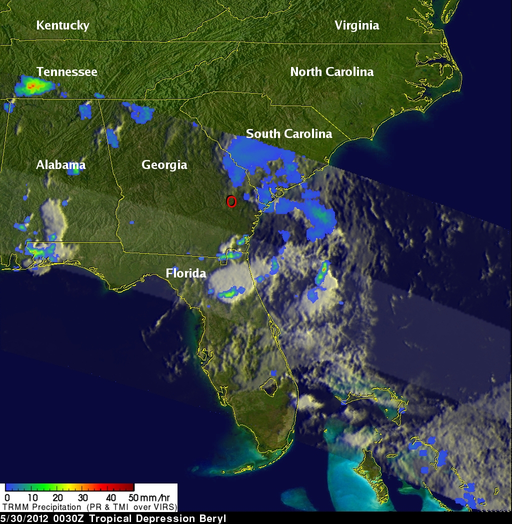
After making landfall in northeast Florida, Beryl continued westward into south-central Georgia before recurving back towards the northeast and accelerating over the coastal Carolinas back out into the Atlantic. In the process, Beryl brought much needed rain to portions of the drought-stricken Southeast.
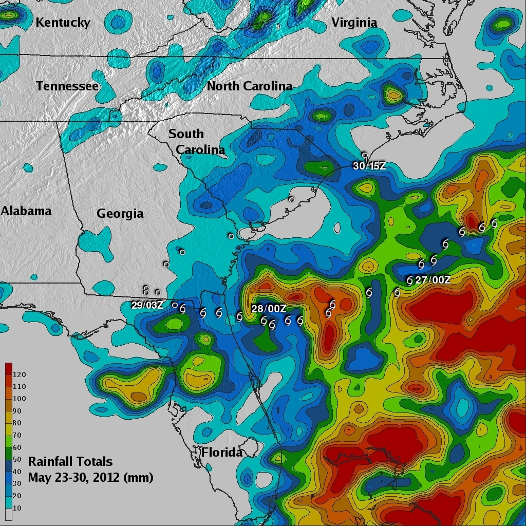
The Tropical Rainfall Measuring Mission (or TRMM) satellite was launched back in November of 1997 with the primary mission of measuring rainfall from space using a combination of passive microwave and active radar sensors. TRMM can also be used to calibrate rainfall estimates from other satellites for expanded coverage. The TRMM-based, near-real time Multi-satellite Precipitation Analysis (TMPA) at the NASA Goddard Space Flight Center provides estimates of rainfall over the global Tropics. TMPA rainfall totals are shown here for the southeastern United States and the surrounding region for the period 23 to 30 May 2012. Appropriate storm symbols are overlaid showing the storm's track and intensity. The highest rainfall totals over land occur over the north-central Florida peninsula where they are upwards of 80 mm (~3 inches, shown in gold). Locally, upwards of a foot of rain was reported across portions of north Florida. Meanwhile lighter amounts (shown in light blue) extend across southeast Georgia with somewhat heavier amounts across North and South Carolina. While Beryl did not relieve the drought, it did bring at least temporary relief to areas that really needed it.