
Tropical Storm Chantal
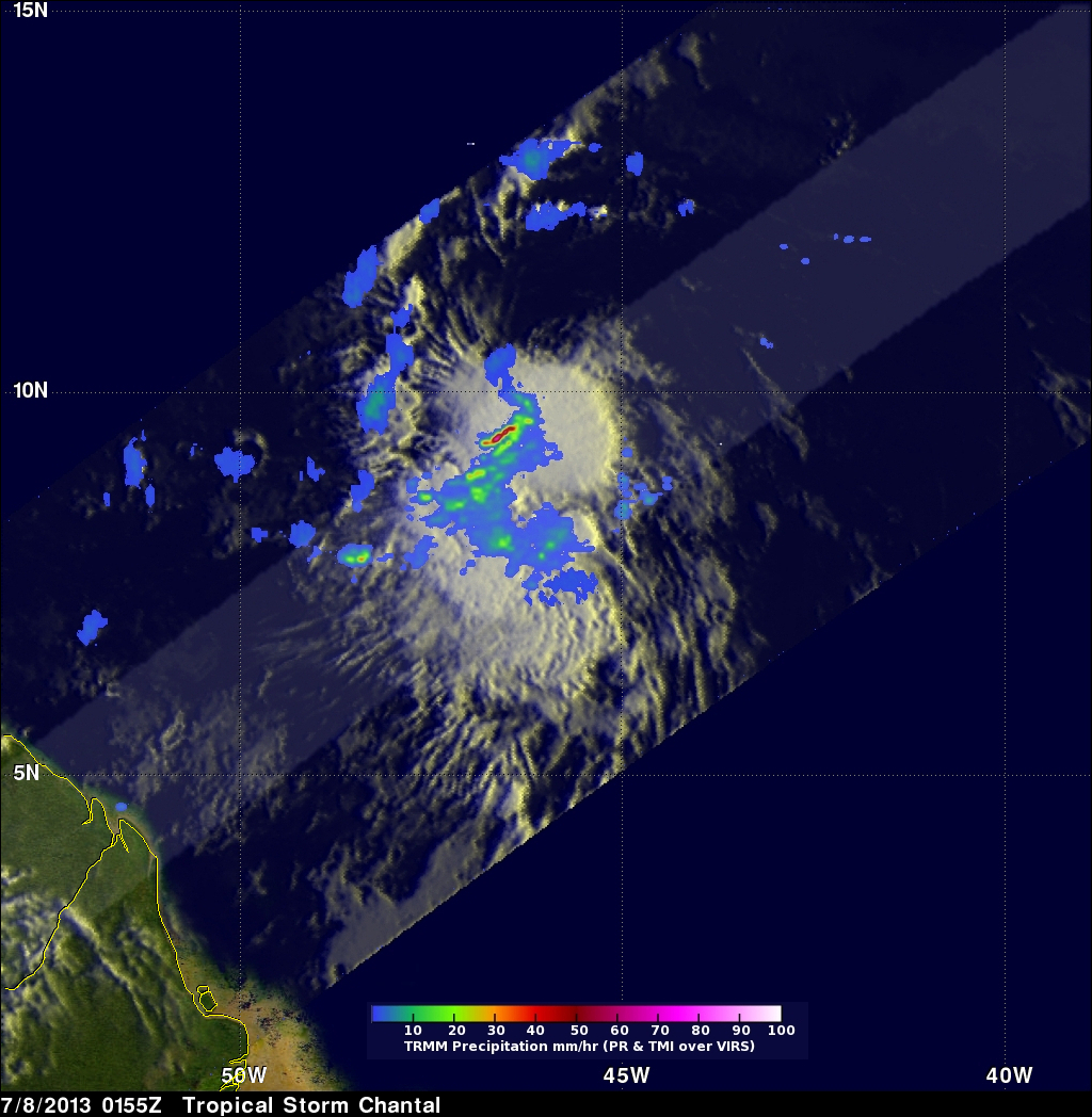
The TRMM satellite had a very good view of forming tropical storm Chantal, east-southeast of the Lesser Antilles, on July 8, 0155 UTC. TRMM Microwave (TMI) and Precipitation Radar (PR) rainfall data are shown overlaid on an enhanced infrared image from the Visible and InfraRed Scanner (VIRS). This analysis shows that the most intense rain was falling at a rate of over 115.5 mm/hr (~4.5 inches) near Chantal's center of circulation.
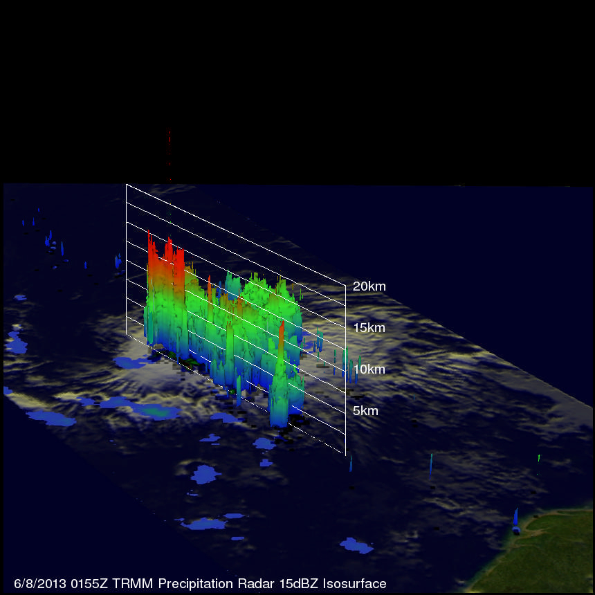
This simulated 3-D view, looking from the west, uses TRMM's Precipitation Radar (PR) instrument to show the very powerful storms near Chantal's center of circulation that were reaching heights of over 15.0km (~9.3 miles). Intense rainfall within these storms returned reflectivity values of over 51 dBZ to the satellite.
The National Hurricane Center (NHC) predicts that Chantal will remain a tropical storm as it moves rapidly toward the north-northwest. Chantal is expected to hit the Lesser Antilles tomorrow and affect the Dominican Republic, Haiti and eastern Cuba within a few days.
Click here to see a simulated 3-D (Quicktime) flyby over Chantal using these TRMM PR data.
Click here to see a simulated 3-D (MPEG) flyby over Chantal using these TRMM PR data.