
Tropical Storm Chantal Enters the Eastern Caribbean
Since forming on the night (EDT) of 7 July 2013 in the tropical central Atlantic, Tropical Storm Chantal has continued to race westward at up to 29 mph (~46 kph) and has now entered the eastern Caribbean with sustained winds reported at 65 mph (~100 kph) by the National Hurricane Center.
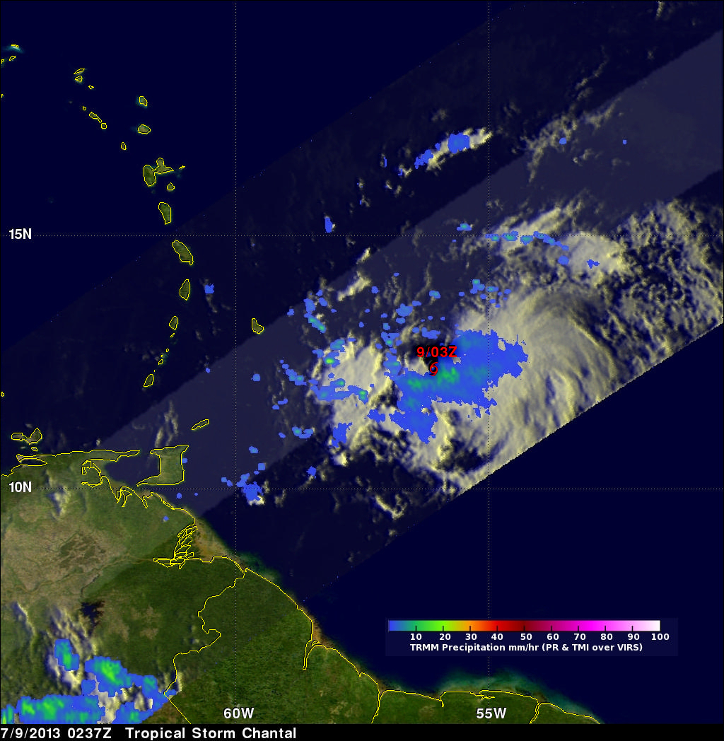
TRMM captured this latest image of Chantal at 02:37 UTC 9 July 2013 (10:37 pm EDT 8 July) as Chantal was approaching the Lesser Antilles. The image shows the horizontal distribution of rain intensity within Chantal. Rain rates in the center of the swath are from the TRMM Precipitation Radar (PR), and those in the outer swath are from the TRMM Microwave Imager (TMI). The rain rates are overlaid on infrared (IR) data from the TRMM Visible Infrared Scanner (VIRS).
TRMM reveals that Chantal is a rather small storm with a modest amount of rain located mostly south and east of the center as shown by the blue and green areas indicating light to moderate rain, respectively, below and to the right of the storm symbol. TRMM, however, does show some evidence of banding (curvature) in the surrounding rain bands, an indicator of the storm's circulation.
Chantal is unusual in two regards. It is the first tropical storm to form this early in the season so far out into the Atlantic since Hurricane Bertha back in 2008, which holds the record for being the eastern-most July storm. And second, storms that move as fast as Chantal typically have a difficult time intensifying or maintaining their strength, but Chantal has managed so far to intensify into a strong tropical storm.
Over the next several days, Chantal is expected to continue moving quickly and turn towards the northwest in the direction of the Dominican Republic before slowing down and passing through the Bahamas later in the week as a tropical storm.