Tropical Storm Cimaron Brings Beneficial Rain To China
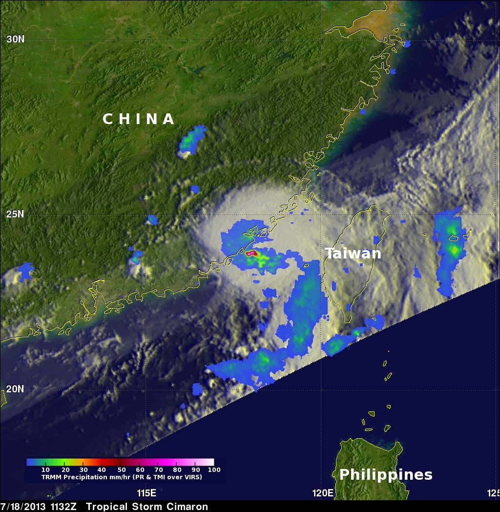
The image on the left used data captured by the TRMM satellite when it passed above tropical storm Cimaron on July 18, 2013 at 1132 UTC (~7:32 PM Local) just before it hit southeastern China. Rainfall was measured by TRMM's Microwave Imager (TMI) and Precipitation Radar (PR) instruments to be falling at a rate of over 183mm/hr (~7.2 inches) in a small area near Cimaron's center of circulation. TRMM PR found some radar reflectivity values greater than 55dBZ in these heavy rainshowers. Cimaron's track took it to the south of Taiwan yesterday.
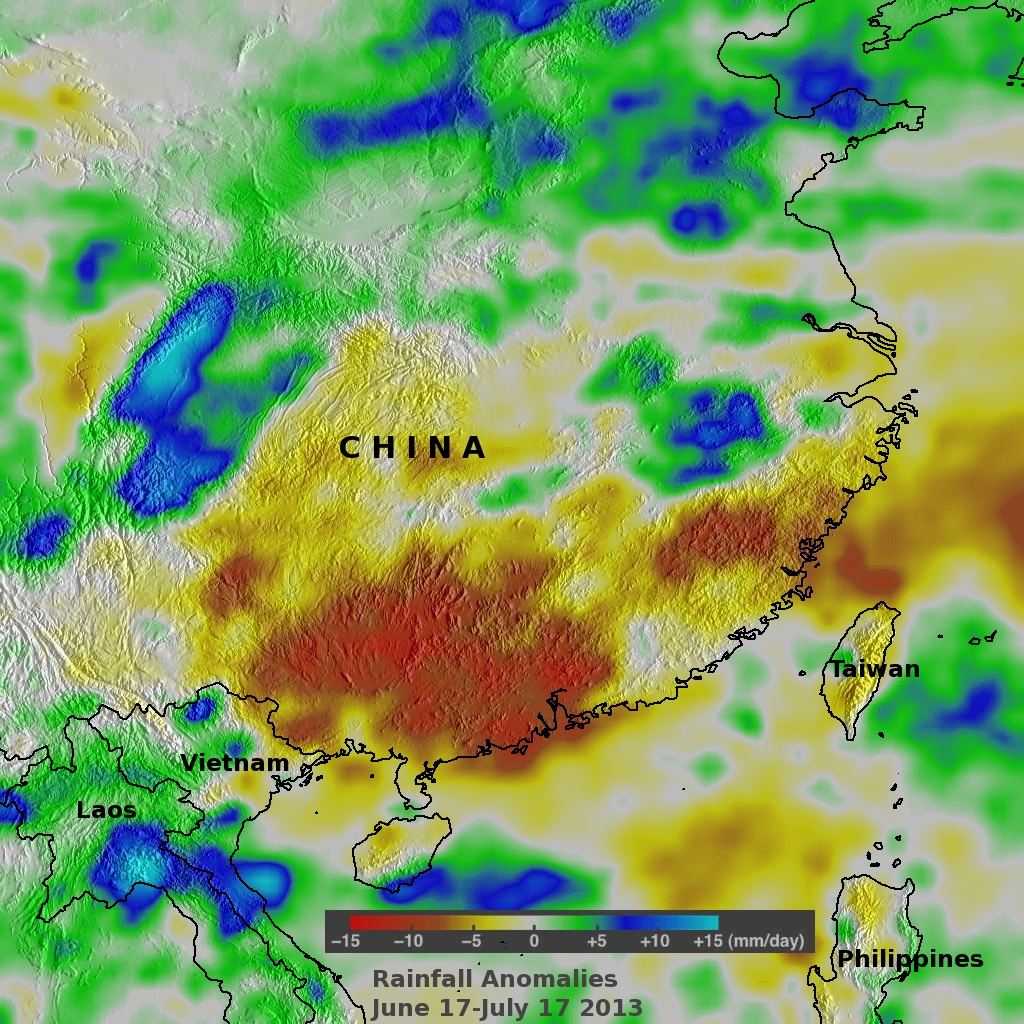
The rainfall anomaly analysis on the right was made by comparing rainfall data compiled during the twelve year period from 2001-2012 to "near real-time" TRMM calibrated Multi-satellite Precipitation Analysis (TMPA) data collected during the last thirty days. This analysis shows that Cimaron's rainfall may be very beneficial to China. Even with the recent precipitation from typhoon soulik, rainfall would have to increase by an average of over 10mm/day to bring totals back to normal in large areas of southern China.