
Tropical Storm COSME Becoming Stronger
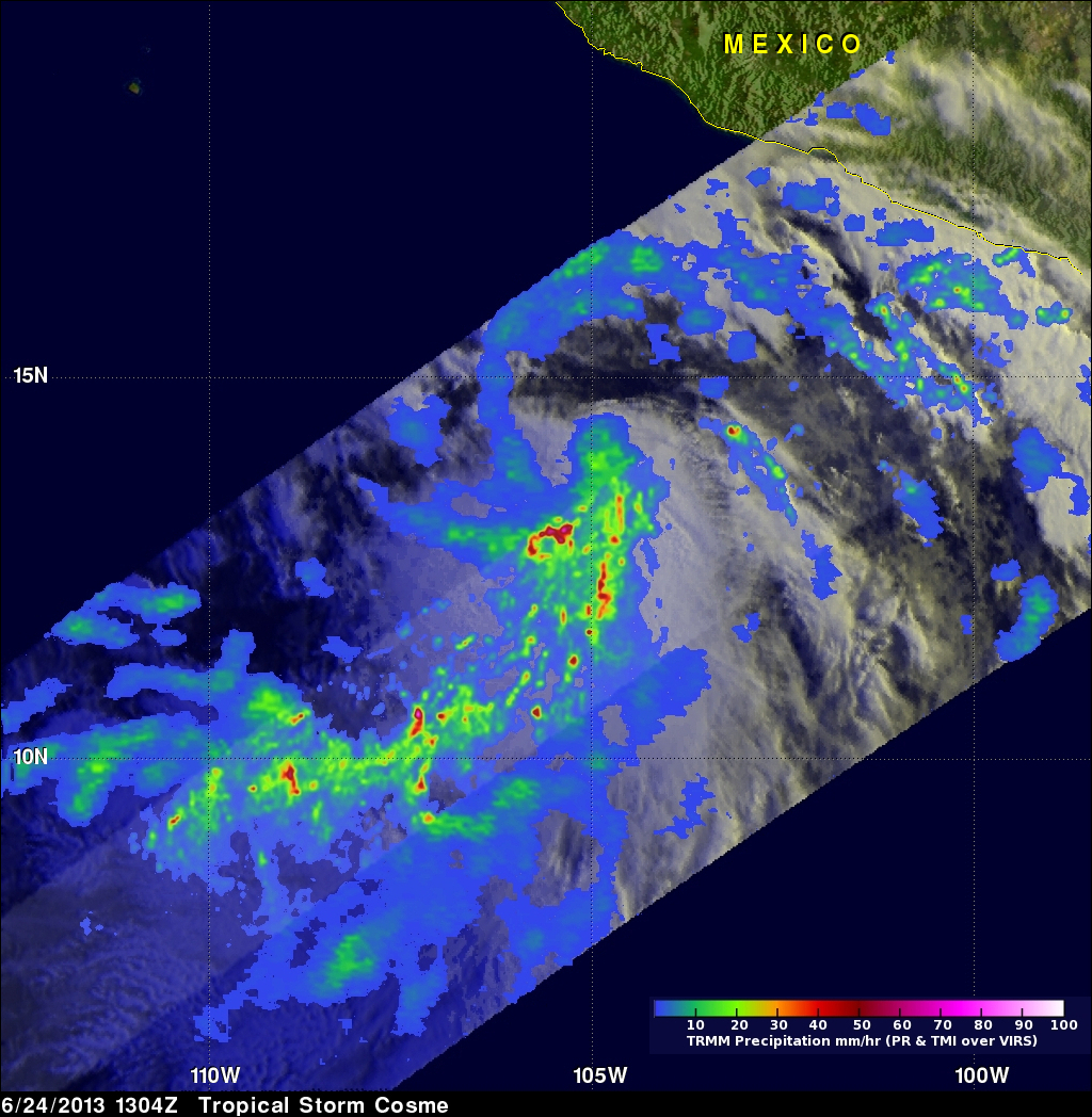
Tropical storm Cosme was illuminated by morning sunlight when the TRMM satellite flew over on June 24, 2013 at 1304 UTC (8:04 AM PDT). COSME had become much better organized since being upgraded to a tropical depression 24 hours earlier. A rainfall analysis derived from TRMM's Microwave Imager (TMI) and Precipitation (PR) data are shown overlaid on a visible/infrared image from TRMM's Visible and InfraRed Scanner (VIRS). TRMM PR found rain falling at a rate of over 113 mm/hr (~4.4 inches) just to the south of Cosme's center of circulation.
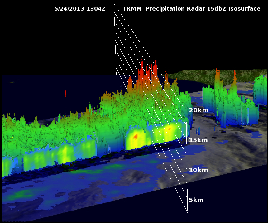
TRMM's Precipitation Radar (PR) data were used to show Cosme's 3-D vertical structure. TRMM PR found that heavy rain within some storms was returning radar reflectivity values greater than 51dBZ. The tops of some of these storms were reaching heights above 16.5km (10.3 miles) .