Tropical Storm Dolly Hits Eastern Mexico
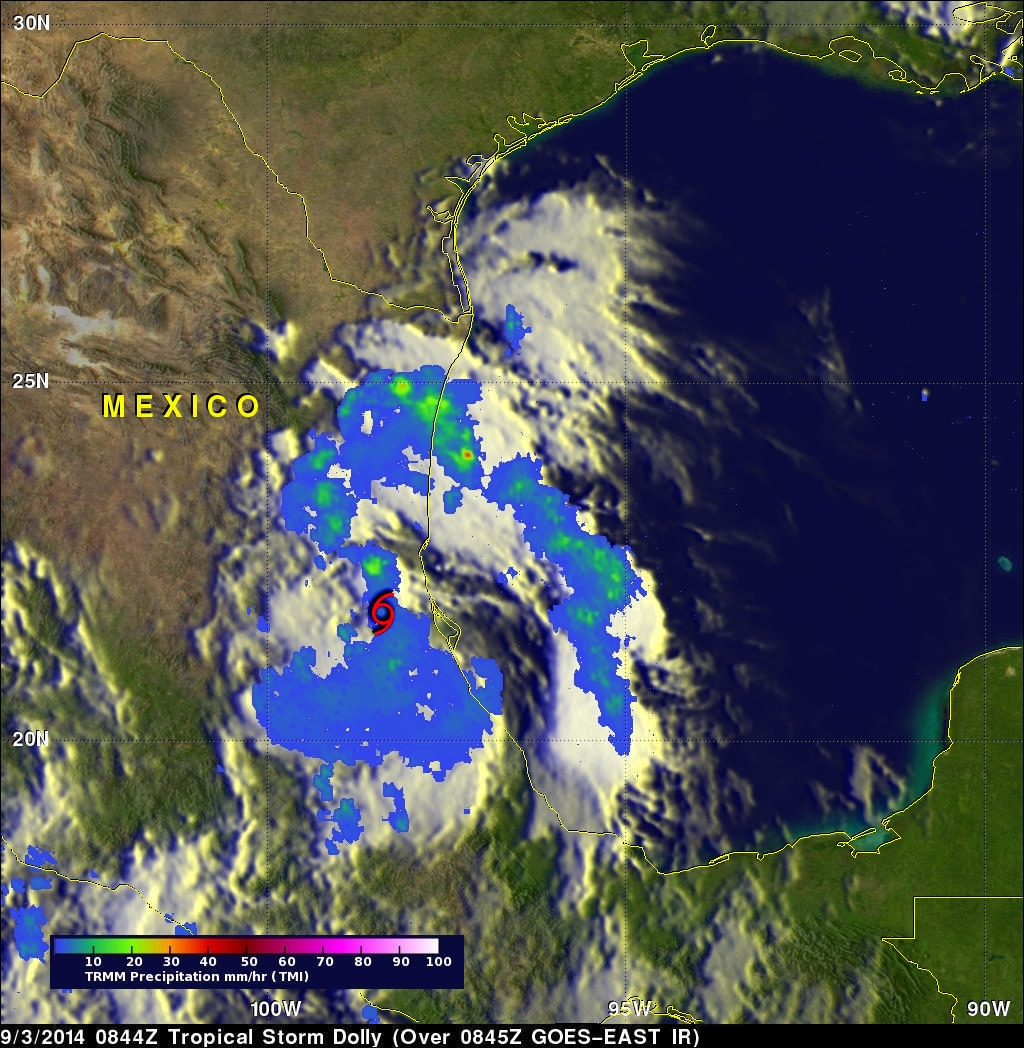
Tropical storm Dolly is dissipating after coming ashore in eastern Mexico late yesterday evening. The TRMM satellite flew over tropical storm Dolly early on September 3, 2014 at 0844 UTC ( 3:33 AM CTD) providing data used in the image above. TRMM's Microwave Imager (TMI) collected with that orbit showed that Dolly was dropping light to moderate rainfall near the dissipating storm's center of circulation. Moderate to heavy rainfall, falling at a rate of over 30 mm ( about 1.2 inches) per hour, was shown in a strong band of showers moving ashore north of Dolly's center.
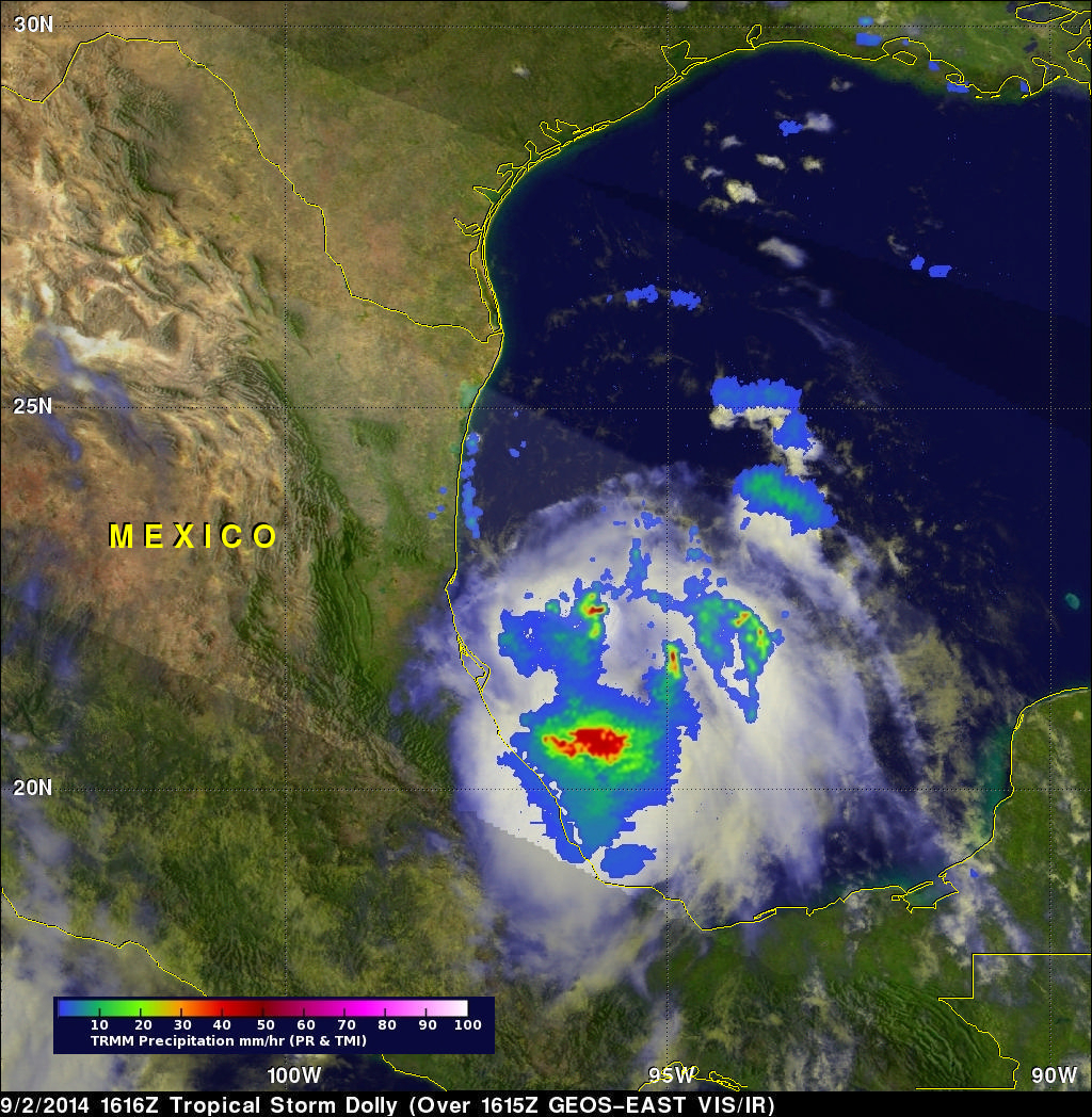
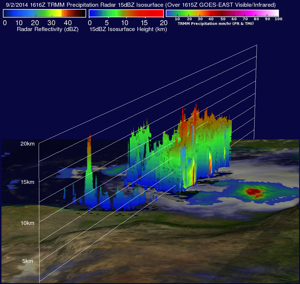
The TRMM satellite had a good daylight look at Dolly yesterday on September 2, 2014 at 1616 UTC (11:16 AM CDT). Strong north-northwesterly vertical shear was pushing powerful convective thunderstorms to the south of the tropical cyclone's center. Some of these storms were dropping rain at a rate of almost 83 mm (3.3 inches) per hour. These intense storms are shown in the 3-D view derived from TRMM's Precipitation Radar (PR) reflectivity data values. Some tops of these storms are shown towering to heights of over 15km ( about 9.3 km).