
Tropical Storm Dylan (ELEVEN) Heads Toward Queensland
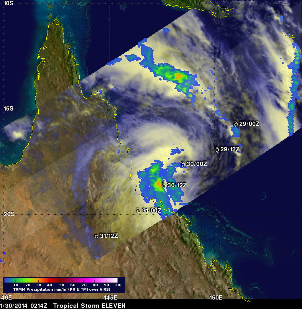
Tropical storm Dylan was heading from the Coral Sea toward Australia's Queensland coast when it was viewed by the TRMM satellite on January 30, 2014 at 0214 UTC. The rainfall analysis above used data collected by TRMM's Microwave Imager (TMI) and Precipitation Radar (PR) instruments. Rainfall is shown overlaid on an enhanced visible/infrared image from TRMM's Visible and InfraRed Scanner (VIRS). TRMM's TMI data revealed that moderate to heavy rain falling at a rate of over 31 mm/hr (about 1.2 inches) was preceding Dylan's movement toward the Australian coast.
Dylan's approximate past and forecast locations are shown overlaid in white. The Joint Typhoon Warning Center (JTWC) predicts that Dylan will weaken from a tropical storm with winds of about 50 kts (about 58 mph) to a tropical depression with winds of 30 kts (about 35 mph) as it moves over Queensland.
Click here to see a Low Resolution 51x512 Quicktime animation that fades from VIRS to the TMI/PR rainfall analysis.
Click here to see a Low Resolution 51x512 MPEG animation that fades from VIRS to the TMI/PR rainfall analysis.