
Tropical Storm Ernesto In The Gulf Of Mexico
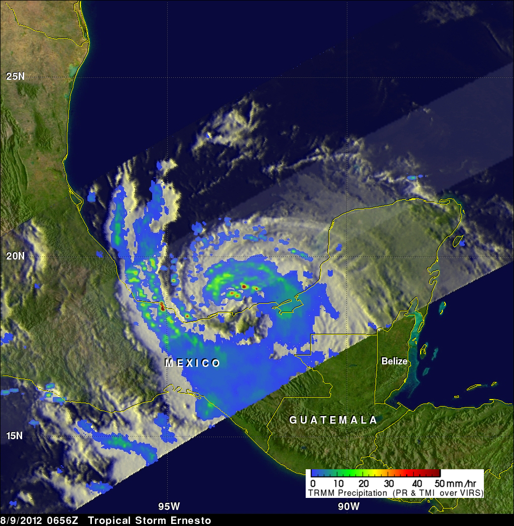
The TRMM satellite saw Ernesto on August 9, 2012 at 0656 UTC ( 2:36 AM EDT) after the tropical storm had moved from the Yucatan Peninsula into the Gulf of Mexico. An analysis of TRMM Microwave Imager (TMI) and Precipitation Radar (PR) rainfall is shown in the image above. This analysis shows that powerful convective thunderstorms were dropping rain at a rate greater than 50mm/hr (~2 inches) north of the storm's center.
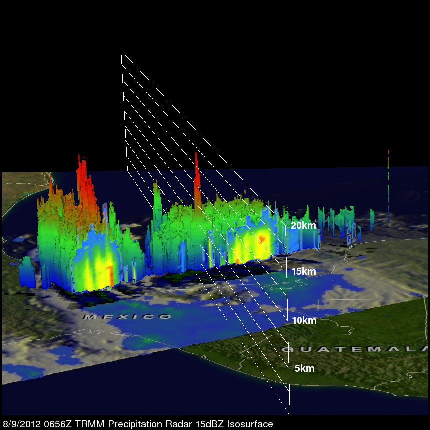
TRMM Precipitation Radar (PR) data were used in the image below to show a 3-D view of Ernesto's vertical structure. This PR view shows that a few of the powerful convective storms near Ernesto's center were pushing to heights of over 16km (~9.94 miles). The energy released by these storms near Ernesto's center can be a sign of intensification.
The National Hurricane Center (NHC) predicts that Ernesto may intensify to minimal hurricane status with winds of 65 kts (~75 mph) as it moves west-southwestward over Mexico this afternoon. Click here to see earlier TRMM information about tropical storm Ernesto