Tropical Storm Fernand Over Eastern Mexico
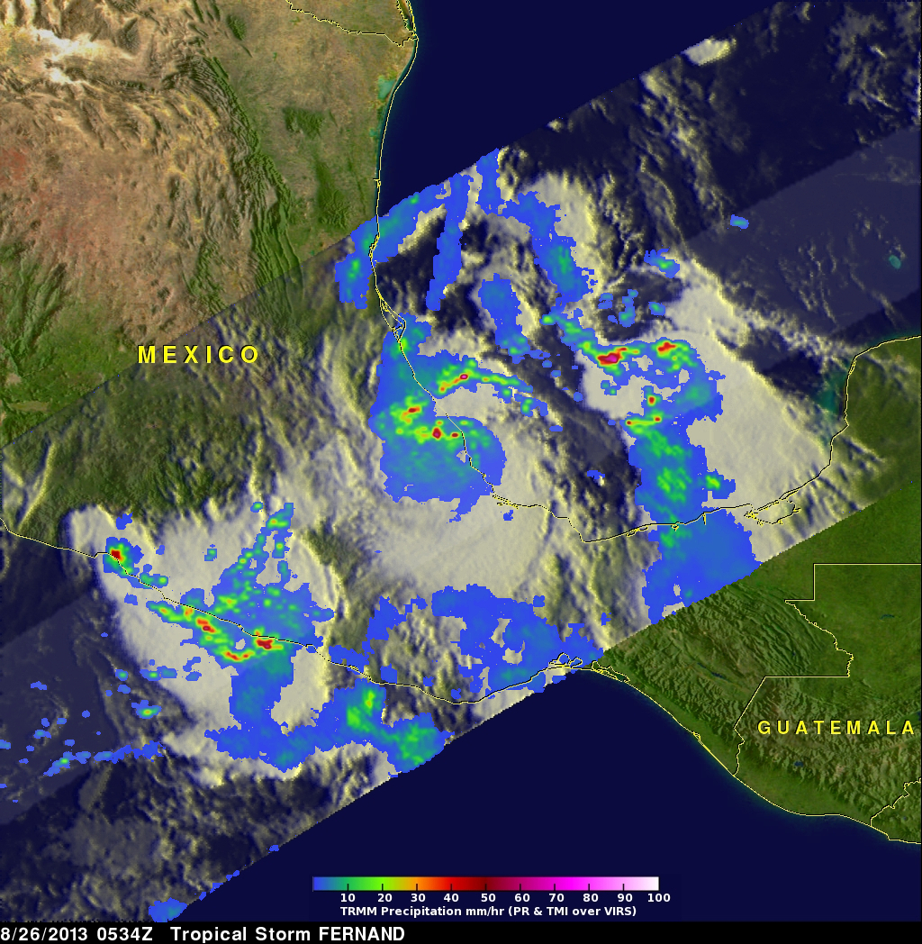
Tropical storm Fernand was drenching the state of Veracruz on Mexico's Gulf Of Mexico coast when the TRMM satellite flew over on August 26, 2012 at 0534 UTC. A rainfall analysis from TRMM's Microwave Imager (TMI) and Precipitation Radar (PR) instruments is shown overlaid on an enhanced infrared image from TRMM's Visible and InfraRed Scanner (VIRS). TRMM PR found rain falling at a rate of over 118mm/hr (~4.6 inches) in rain bands north of Fernand's center of circulation. TRMM PR data revealed that Fernand had a fairly well defined center.
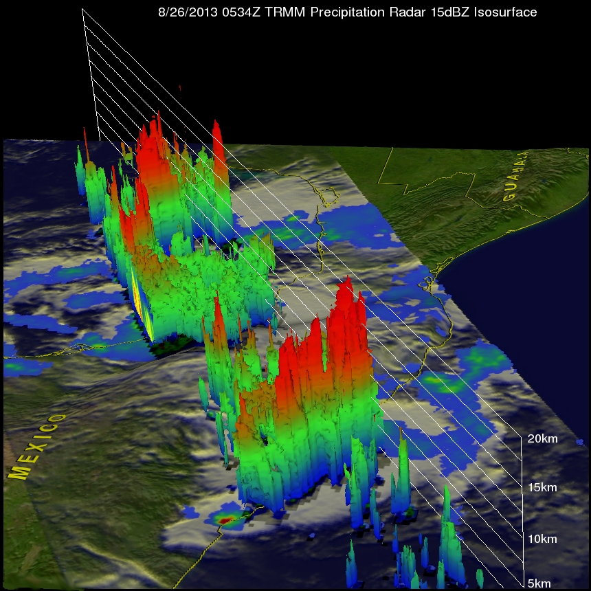
TRMM's Precipitation Radar (PR) data were used in the image below to show Fernand's 3-D structure. This view shows that the tallest thunderstorm tops weren't located within tropical storm Fernand. They were located in storms near Mexico's Pacific coastline and in the Gulf Of Mexico east of Fernand.
Tropical storm Fernand has now weakened below tropical storm intensity while moving northwestward. The National Hurricane Center (NHC) predicts that Fernand will weaken to a remnant low pressure center today. Heavy rainfall from Fernand may still produce some life threatening flash floods and mudslides.
Click here to see a simulated 3-D (Quicktime) flyby animation over Fernand using TRMM PR data.
Click here to see a simulated 3-D (MPEG) flyby animation over Fernand using TRMM PR data.