Tropical Storm Four Forms in the Pacific
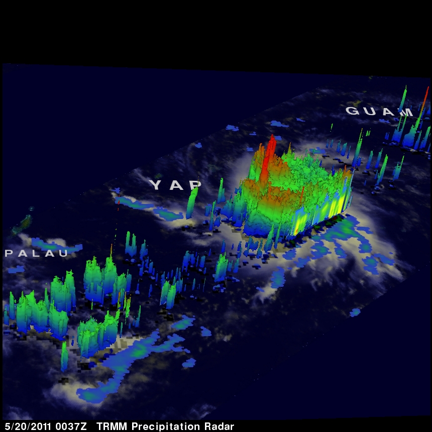
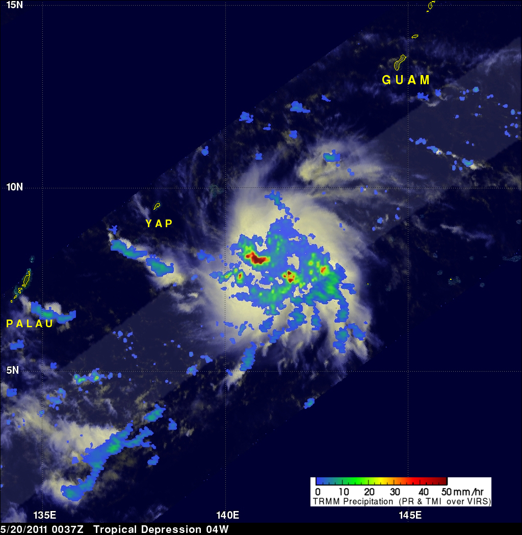
The TRMM satellite flew over rapidly forming TS04W in the western Pacific on 20 May 2011 at 0037 UTC (~10:37 AM LOCAL TIME). This daylight TRMM pass showed that the tropical cyclone was becoming much better organized. The intensifying tropical cyclone now contained several areas of heavy thunderstorms dropping rain at over 50 mm/hour (~2 inches/hour).
The 3-D perspective image on the upper right shows the storm's vertical structure. TRMM's Precipitation Radar (PR) now showed that some thunderstorm towers near the center of circulation were punching up to heights of over 16 km (~9.9 miles) above the ocean's surface. This storm is predicted to become a category 2 typhoon with wind speeds of 90 kts (~103.5 mph) within five days as it moves toward the west-northwest. Click here to see a simulated flyby around this storm courtesy of TRMM's Precipitation Radar data.


