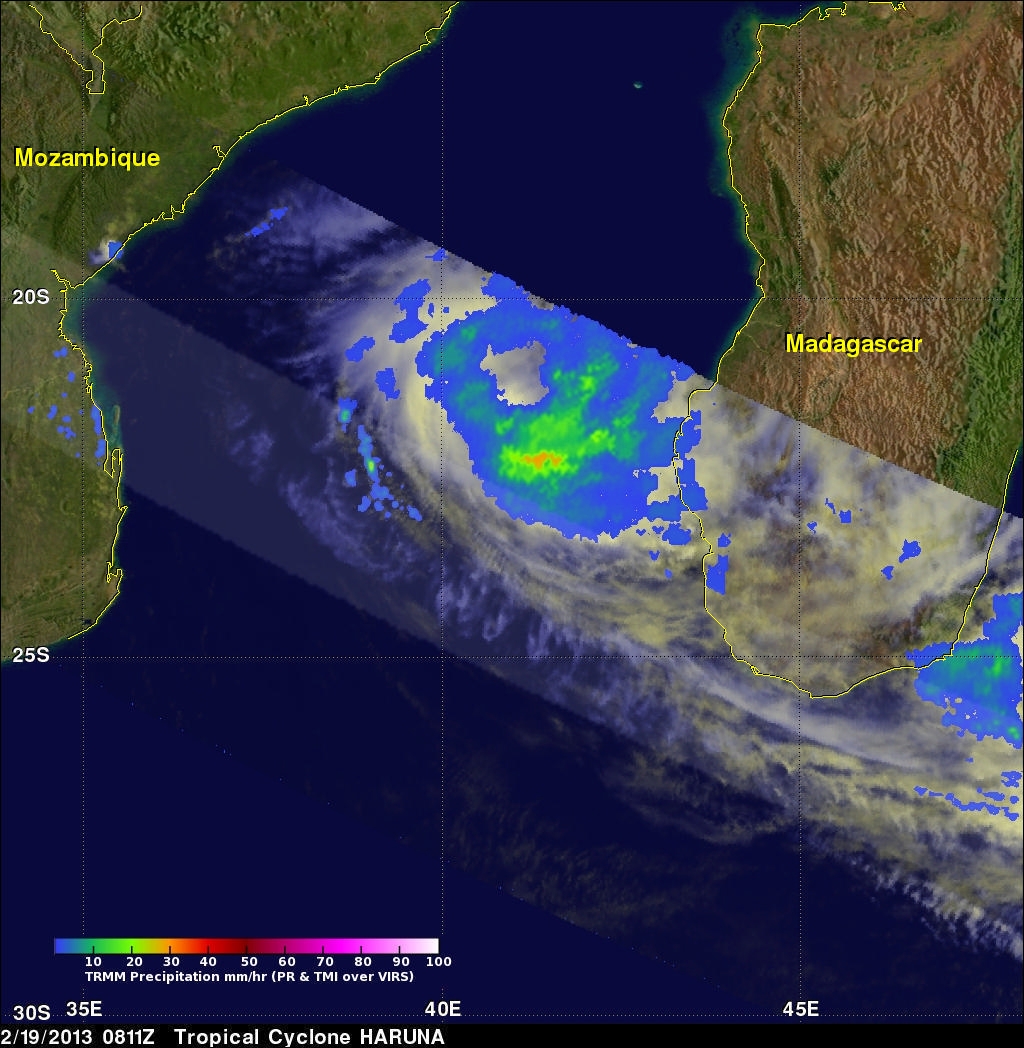
Tropical Storm Haruna Headed For Madagascar
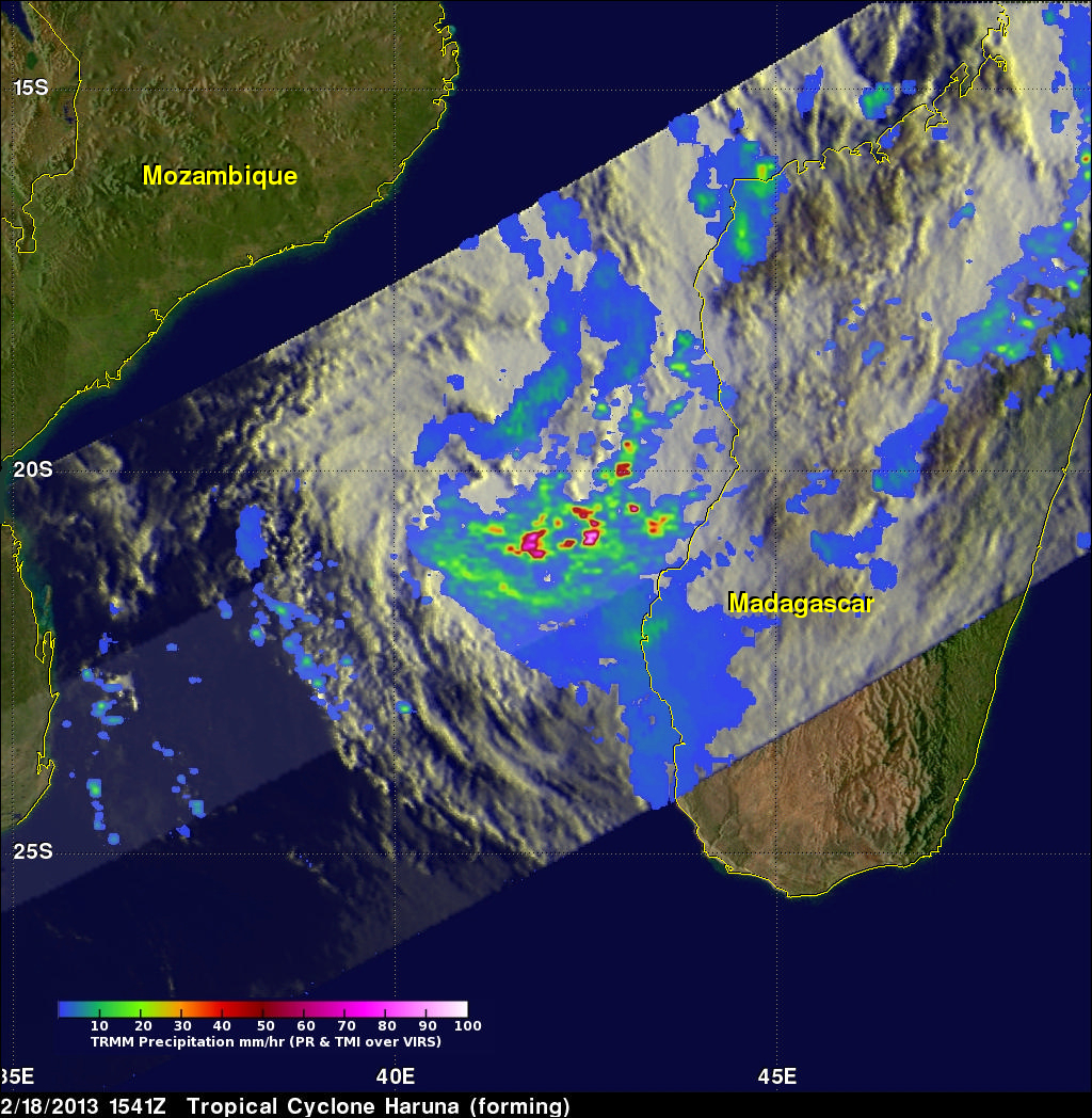
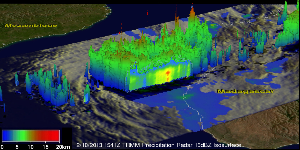
The TRMM satellite had a good look at a tropical storm called Haruna forming in the Mozambique Channel on February 18, 2013 at 1541 UTC. Haruna was called a tropical storm early today and TRMM had another fairly good view when it flew above at 0811 UTC. Haruna is predicted to intensify to a strong tropical storm with wind speeds of about 50kts (~58 mph) and cross southern Madagascar in a couple days. TRMM's Microwave Imager (TMI) and Precipitation Radar (PR) rainfall data were used in the two rainfall analyses shown. TRMM PR showed that very intense rain was falling at a rate of over 134 mm/hr (~5.3 inches) near the forming storm's center of circulation. Haruna's will be drawing warm moist air over Madagascar from the Mozambique Channel for the next few days. The resulting heavy rainfall may result in flooding and landslides.