
Tropical Storm Haruna Intensifying
The TRMM satellite flew above intensifying tropical storm Haruna in the Mozambique Channel again on February 20, 2013 at 0717 UTC. A rainfall analysis using data from TRMM's Microwave Imager (TMI) and Precipitation Radar (PR) instruments is shown overlaid on a combination visible/infrared image from the Visible and InfraRed Scanner (VIRS). TRMM showed that Haruna had become much better organized than yesterday with intense bands of rainfall circling the tropical cyclone's center of circulation.
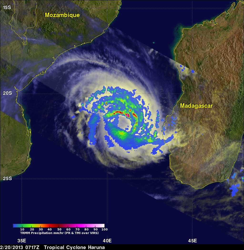
Some rain in powerful storms on the northern edge of Haruna's center was found by TRMM PR to be falling at a rate of over 108 mm/hr (~4.25 inches).
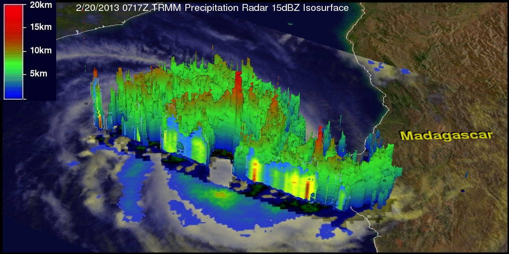
The 3-D image was derived from a TRMM Precipitation Radar (PR) slice through tropical storm Haruna's center. The towering thunderstorms on the northern edge of Haruna's center were shown to be reaching heights of over 14.25km (~8.85 miles). Radar reflectivity values of over 51dBZ were returned to TRMM PR from very heavy rainfall located in the same stormy area. Click here to see a simulated flight above tropical storm Haruna.
Haruna is expected to become more powerful and be a category 2 tropical cyclone on the Saffir-Simpson hurricane scale with winds of 85kts (~98 mph) before hitting southern Madagascar in a couple days.