Tropical Storm Ingrid Getting Stronger
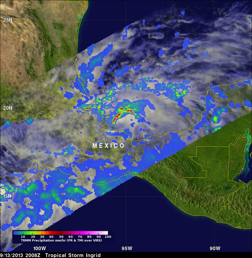
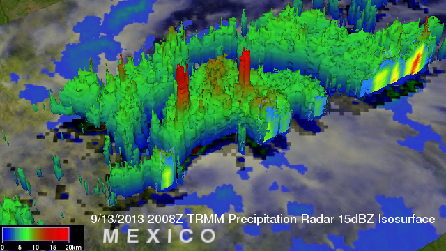
Tropical storm Ingrid in the southern Gulf Of Mexico was strengthening when the TRMM satellite flew over on September 13, 2013 at 2008 UTC (4:08 PM EDT). A band of very strong convective storms north of Ingrid's center was observed by TRMM's Precipitation Radar (PR) instrument to contain rain falling at the rate of over 143 mm/hr (~5.6 inches). Powerful thunderstorms in this area were also found by TRMM PR to reach heights above 16km (~9.9 miles). These "hot towers" are often a sign that a tropical cyclone will intensify.


