
Tropical Storm Iselle Departs Hawaii While Julio Stays Well North
Iselle was once a rather powerful category 4 hurricane in the East Pacific with sustained winds estimated at 120 knots (~138 mph) by the National Hurricane Center. Fortunately, a combination of southwesterly wind shear, drier air and cooler waters weakened Iselle considerably as it approached the Hawaiian Islands. Although much weaker, Iselle still struck the southeast Kau coast of the Big Island of Hawaii as a rather strong tropical storm. In fact Iselle, was the strongest and only the 2nd tropical storm to hit the Big Island in over 50 years. The center made landfall around 2:30 am HST Friday August 8th near Pahala with sustained winds of 60 mph. The Big Island bore the brunt of the storm where downed trees and power lines left 25,000 people without power. Currently, several days after the storm, around 8,000 are still without power on the island. After hitting the Big Island, Iselle continued to track to the west-northwest keeping the center of circulation well south of the rest of the Hawaiian Islands, which mainly received just rain from Iselle's outer rain bands. On Kauai, however, one woman was reported to have been swept away and drowned while hiking.
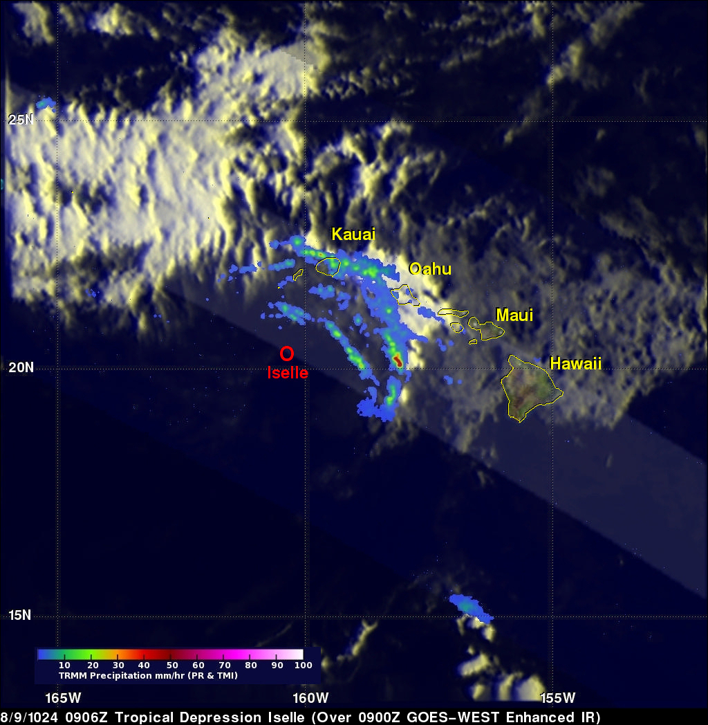
TRMM captured this image of Iselle at 09:06 UTC 9 August (11:06 pm 8 August local) 2014 as the center was passing well south of the far western islands of Kauai and Ni'ihau. By this time Iselle had been degraded to a tropical depression, and TRMM shows the now exposed center of Iselle, which is devoid of any eye wall or even rain. There are several outer rain bands located only on the northeast side of the storm that were still effecting the western part of the state.
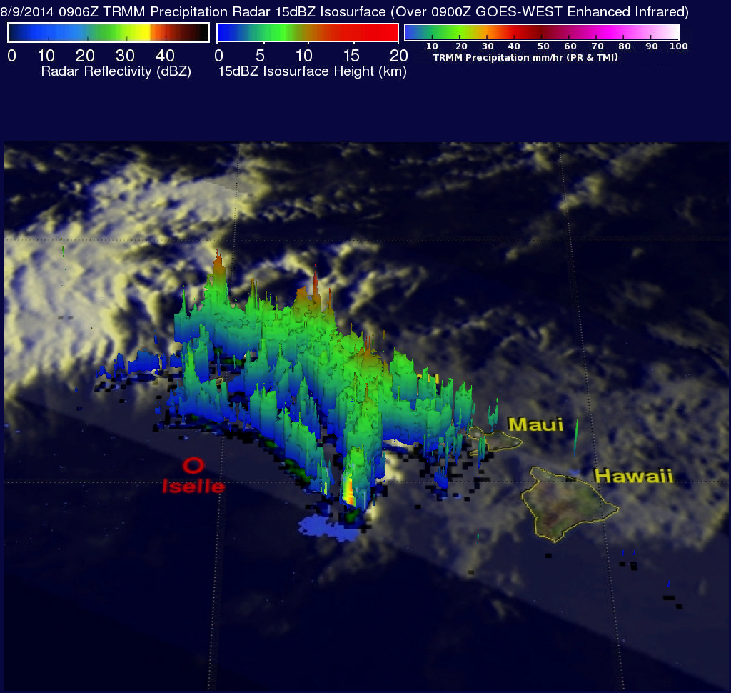
The next image was taken at the same time as the first and shows a 3D view of Iselle looking north. Areas in green show that much of the rain is relatively shallow with tops ranging from about 5 to 8 km, but there are isolated areas of higher tops (shown in red) associated with deeper penetrating individual convective cells embedded within the rain bands.
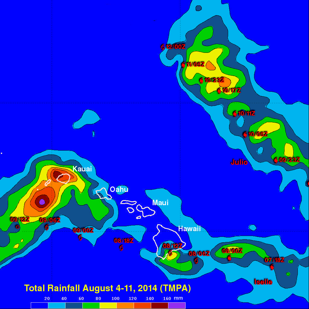
The TRMM-based, near-real time Multi-satellite Precipitation data (TMPA) analysis uses TRMM to calibrate rainfall estimates from other satellites to expand the rainfall coverage of the TRMM satellite. TMPA rainfall estimates are shown here for the period 4 to 11 August 2014 for the Hawaiian Islands and surrounding area. Two swaths of heavier rain show the paths (also identified by the storm symbols) taken by Iselle and Julio, which formed a few days after Iselle and followed a path slightly more to the north. Rainfall totals due to Iselle are on the order of 60 to 80 mm (~3 inches, green) over the southeast coast of Hawaii and upwards of 120 mm (~5 inches, red) over Kauai. Locally, up to 14 inches of rain was reported in the higher elevations of the Big Island. Julio, which is now a tropical storm, is currently located well north of Oahu (about 500 miles from Honolulu) and expected to continue moving away from Hawaii and steadily weaken.