
Tropical Storm Koji
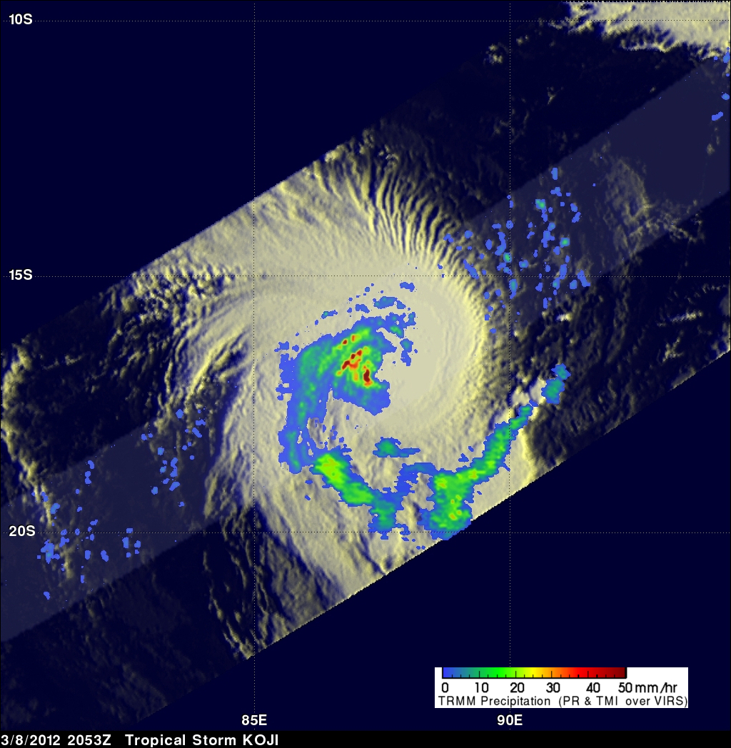
The TRMM satellite passed directly above an intensifying tropical storm in the South Indian Ocean called KOJI on 8 March 2012 at 2053 UTC. The rainfall analysis above was made from TRMM Microwave Imager (TMI) and Precipitation Radar (PR) data. Those TRMM data reveal that KOJI was getting organized with bands of heavy rainfall spiraling into the storm's center. KOJI has been predicted to increase in intensity and reach hurricane force with peak winds of 70kts (~80 mph) on 10 March 2012. KOJI is predicted to remain at hurricane force for only one day and then weaken while traveling southwestward over the open waters of the South Indian Ocean.
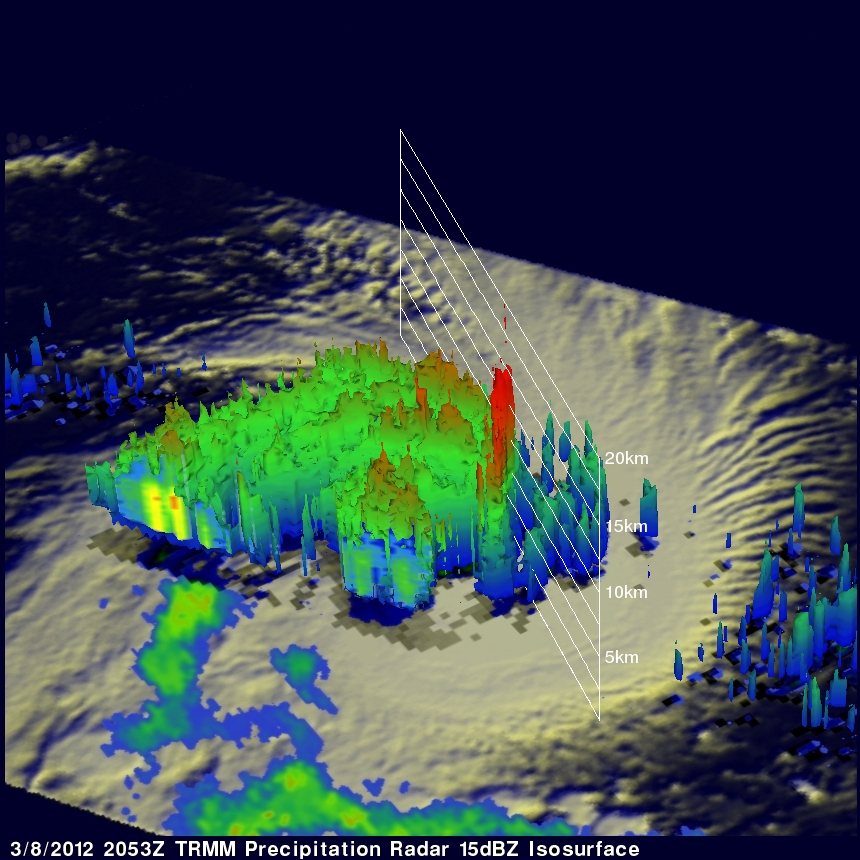
One of the most important features of TRMM's Precipitation Radar (PR) instrument is its ability to provide three dimensional profiles of precipitation from the surface up to a height of about 20km (12.4 miles). PR data from the flight over tropical storm KOJI are shown in the 3-D image above. Those data reveal that an eye hadn't formed but powerful storm towers around KOJI's center were reaching heights of almost 15km (~9.3 miles).