
Tropical Storm Talim's Heavy Rainfall Over Taiwan
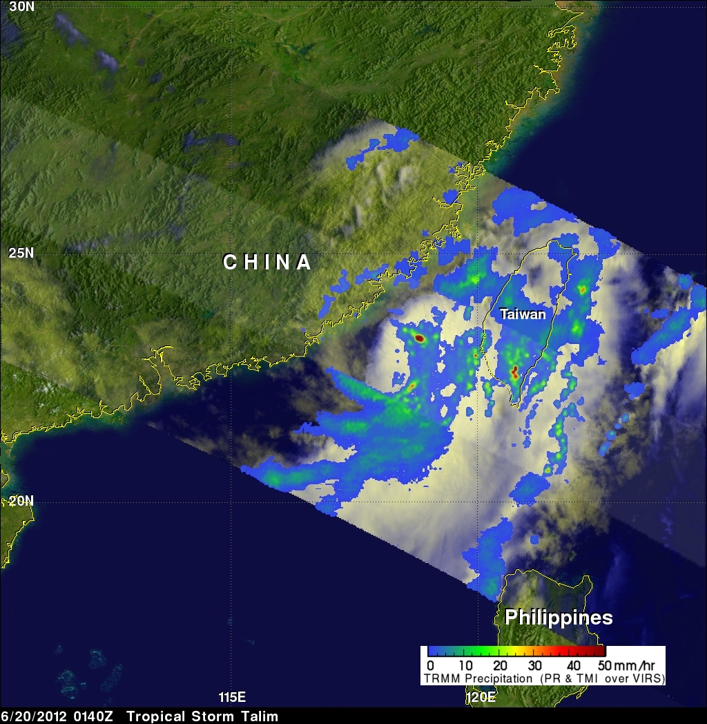
Tropical storm Talim has produced torrential rainfall over southern Taiwan as it pumped warm moist air from the South China Sea over mountainous terrain. The TRMM satellite flew over tropical storm Talim in the Taiwan Strait on 20 June 2012 at 0140 UTC. TRMM Precipitation Radar (PR) data from this orbit shows that tropical storm Talim was dropping rainfall at a rate of almost 50mm/hr over Taiwan. TRMM data captured with that orbit shows that the most intense rainfall of over 50mm/hr (~2 inches) was located over the Strait Of Taiwan.
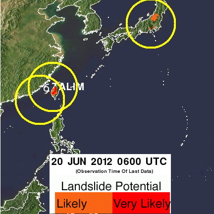
Flash flooding and landslides are probable in southern Taiwan due to heavy rainfall contributed by tropical storm Talim. That area of Taiwan has received almost 600 mm (~23.6 inches) of rainfall over the past week. Maps of potential landslide areas resulting from heavy rainfall are routinely produced and shown on the TRMM web site.
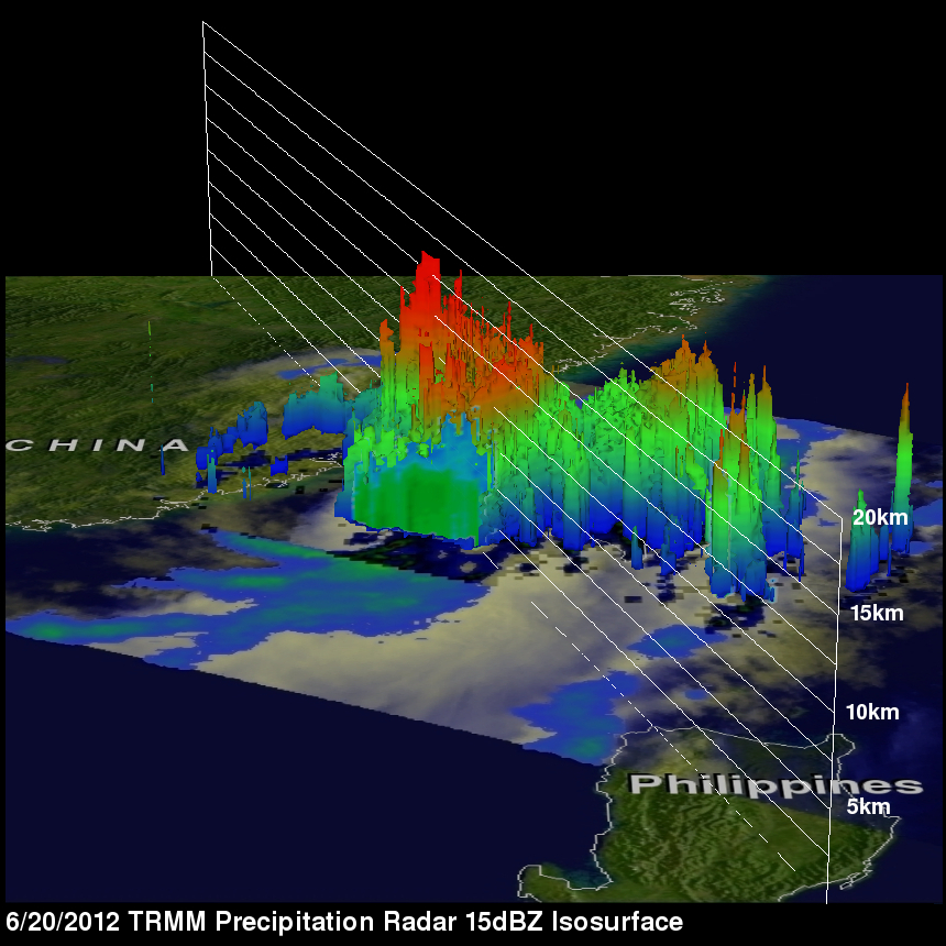
The 3-D image on the right uses data from TRMM's Precipitation Radar (PR) instrument to show the heights of powerful storms near Talim's center in the Strait Of Taiwan. Some powerful storms are shown reaching heights of about 16km (~9.9 miles).