Tropical Storm Washi (27W) Strengthens
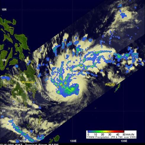
As expected tropical storm Washi (27W) had strengthened when the TRMM satellite passed over on 15 December 2011 at 1515 UTC collecting data used in the rainfall analysis shown above. TRMM Microwave Imager (TMI) and Precipitation Radar (PR) data are shown overlaid on an enhanced infrared image from the satellite's Visible and InfraRed Scanner (VIRS). This rainfall analysis shows that Washi was much better organized with very heavy rainfall of over 50mm/hr (~2 inches) revealed by TRMM PR within bands spiraling into the center of the storm.
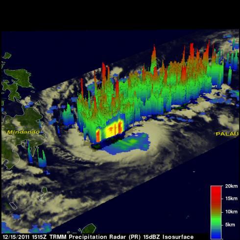
The 3-D image above used Precipitation Radar data from the same TRMM pass and shows that numerous heavy thunderstorms were located throughout the tropical cyclone. The tallest thunderstorms, in the area viewed by TRMM's Precipitation Radar, reaching to heights of over 15km (~9.3 miles) were located in the feeder bands converging into northwest side of the storm.
Washi is predicted to cross over the Philippine island of Mindinao in the next couple days.


