
Two Southern Hemisphere Tropical Cyclones
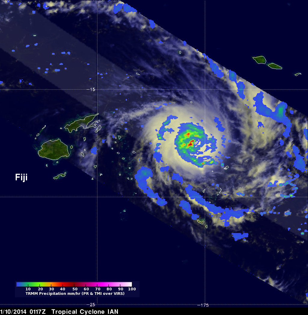
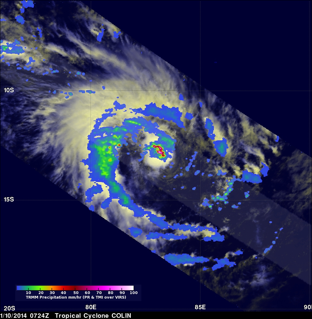
Today the TRMM satellite passed above two tropical cyclones in the southern hemisphere. On January 10,2014 at 0117 UTC TRMM had a good daytime view of intensifying tropical cyclone IAN in the south Pacific Ocean east of Fiji with wind speeds over 90kts (~104 mph). Then at 0724 UTC TRMM passed directly above tropical cyclone Colin in the south Indian Ocean that was also intensifying with wind speeds estimated to be above 35kts (~40 mph). Rainfall derived from TRMM's Precipitation Radar (PR) and Microwave Imager (TMI) data was overlaid on Visible/Infrared images from the Visible and InfraRed Scanner (VIRS). Tropical cyclone Ian was found by TRMM PR to contain rain falling at a rate of over 95mm/hr (~3.7 inches). TRMM PR found COLIN contained precipitation falling at the amazing rate of over 224 mm/hr (~8.8 inches) near the powerful tropical cyclone's eye.
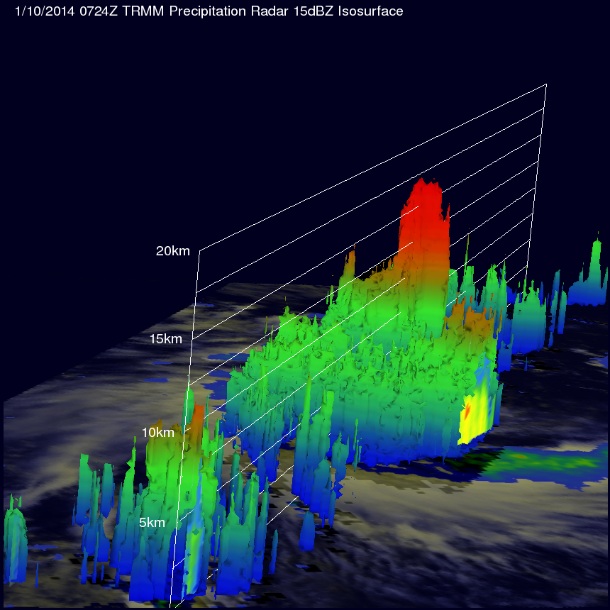
This 3-D view of Colin's vertical structure was made using data from TRMM's Precipitation Radar (PR) instrument. It shows that towering convective thunderstorms near Colin's center of circulation were reaching altitudes above 16km (~9.92 miles). This kind of chimney cloud, also called a "hot tower" (as it releases a huge quantity of latent heat by condensation) can play a part in the formation or intensification of tropical cyclones.