
Two Tropical Cyclones Near Japan
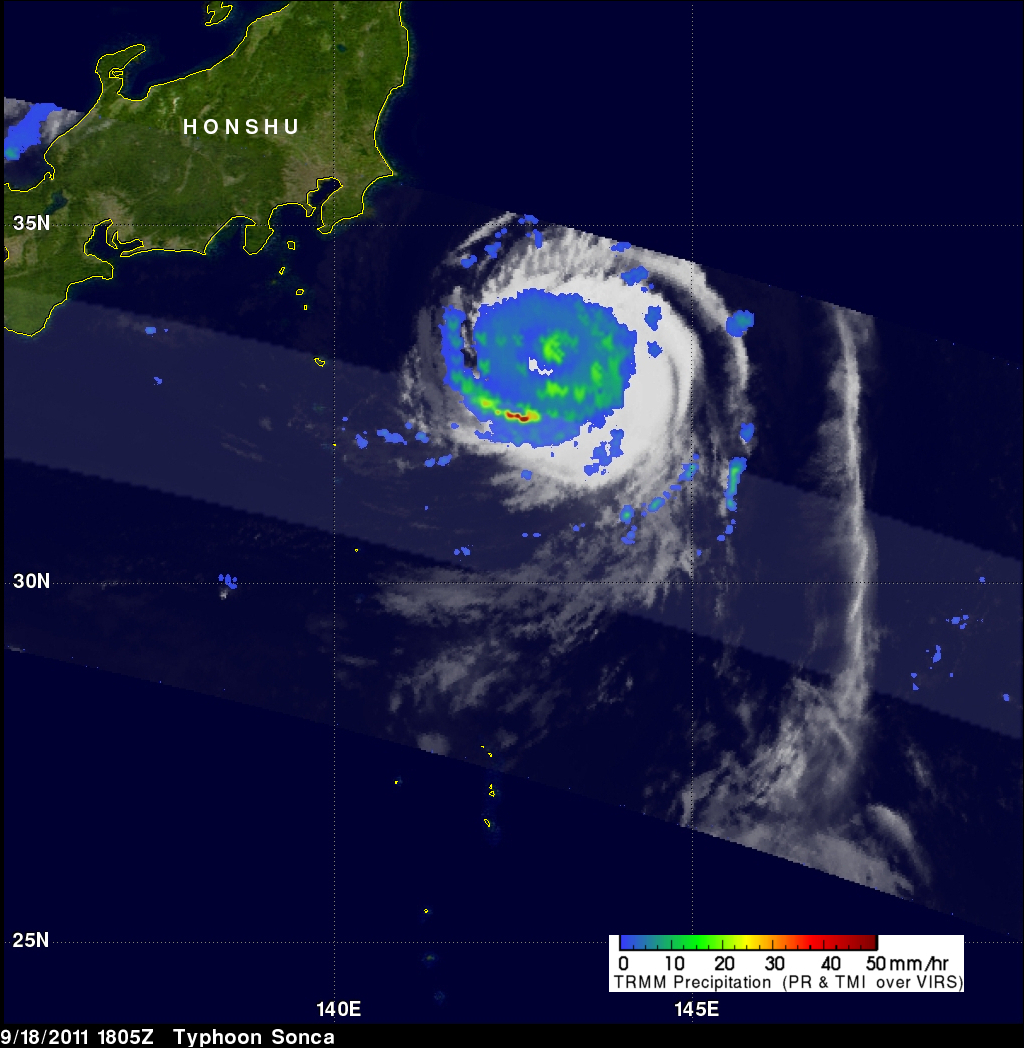
The TRMM satellite flew over two tropical cyclones near Japan on 18 September 2011. Typhoon Sonca, shown above, was seen off the east coast of the main Japanese island of Honshu at 1805 UTC while moving away from Japan toward the north-east. Sonca was still a powerful typhoon with wind speeds of about 85 knots (~98 mph) at that time but Sonca weakened to a tropical storm on 19 September 2011 while moving over the colder waters of the northern Pacific Ocean to the north-east of Japan.
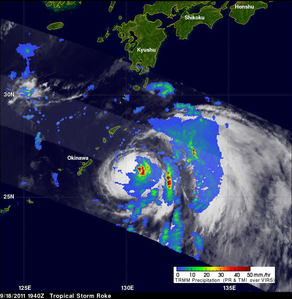
TRMM saw tropical storm Roke a little later at 1840 UTC. TRMM Precipitation Radar (PR) data shows that Roke contained several areas of heavy rainfall on the eastern side, near the center of the storm. Some powerful storms near Roke's center were dropping rainfall at a rate greater than 50mm/hr (~2 inches). TRMM's Microwave Imager (TMI) also revealed that there Roke was producing a large area of rain between the storm and the main islands of Japan. TRMM shows that this large area of rainfall contained smaller lines of intense convective storms. Tropical storm Roke had a well defined circulation at the time of the 18 September TRMM pass and became at minimal typhoon early on 19 September 2011. Roke is expected to travel to the north and then north-east over the main islands of Japan during the next 48 hours.