Typhoon Bopha Devastates Mindanao, Moves Into Sulu Sea
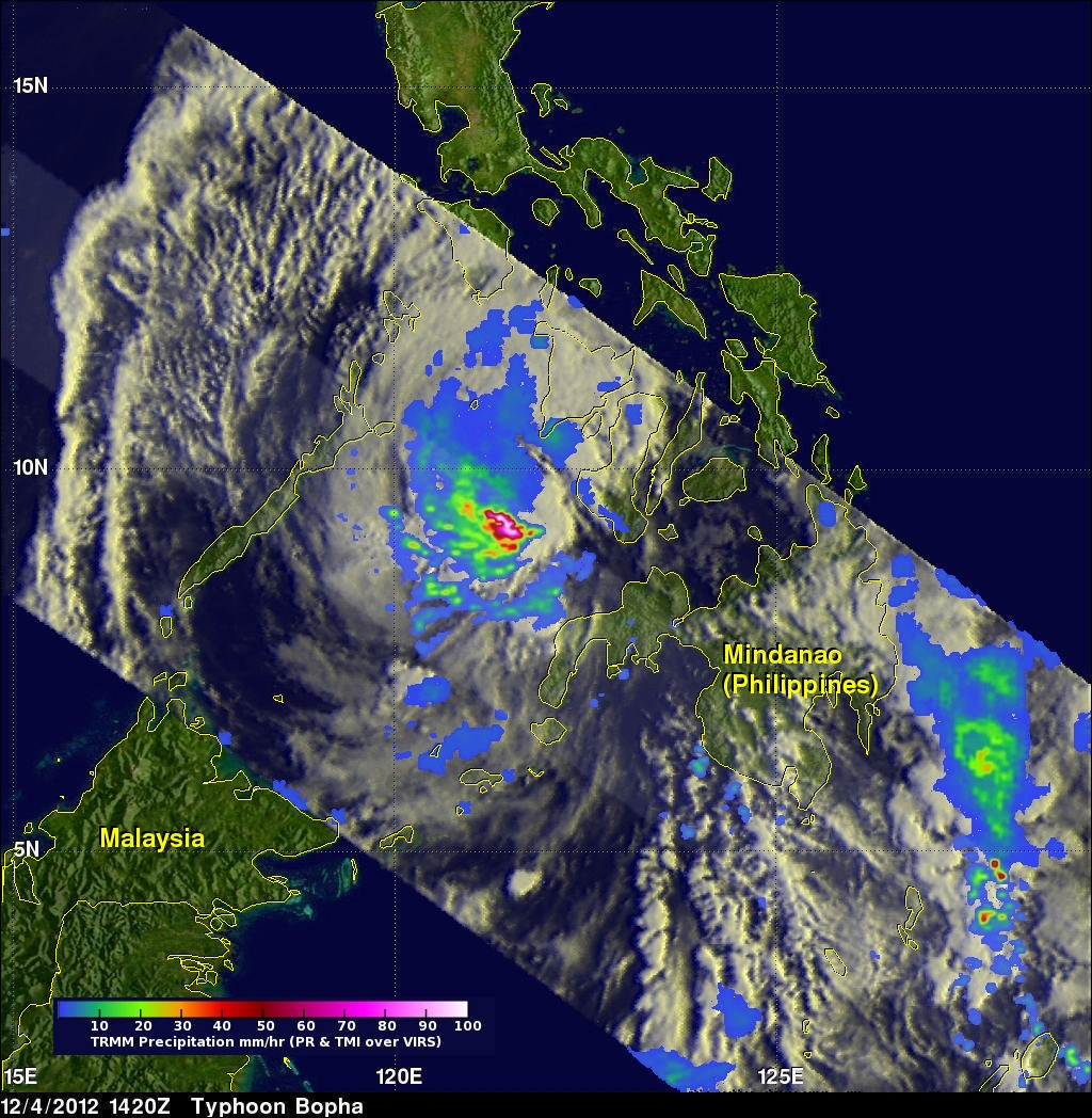
Typhoon Bopha pounded the Philippines with high winds and drenching rain when it crossed the island of Mindanao today. Numerous deaths and wide spread destruction have been reported. The TRMM satellite had a good view of Bopha moving into the Sulu Sea when it flew over on December 4, 2012 at 1420 UTC. This TRMM pass showed that Bopha still had good organization but Mindanao's rugged terrain had taken it's toll. Bopha's eye had been disrupted but TRMM Precipitation Radar (PR) data revealed that very heavy rain was still falling at a rate of over 85 mm/hr (~3.5 inches) near the center of the powerful typhoon.
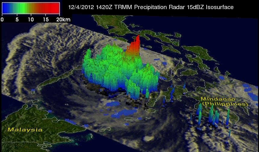
TRMM's Precipitation Radar data were used in the 3-D image above to show typhoon Bopha's vertical structure. Bopha's rainfall was covering a smaller area than on December 3, 2012 but powerful convective storms near the center of the typhoon were still reaching heights above 16km (~9.9 miles). TRMM Precipitation Radar found radar reflectivity values of almost 54 dBz providing more proof that the thunderstorms near Bofa's center were still releasing abundant amounts of energy.