
Typhoon Bopha's Heavy Rain Over Mindanao
High winds, flooding and landslides from heavy rains with typhoon Bopha have caused over 300 deaths in the southern Philippines.
The Tropical Rainfall Measuring Mission (TRMM) satellite's primary mission is the of measurement of rainfall in the Tropics. The TRMM-based, near-real time Multi-satellite Precipitation Analysis (MPA) at the NASA Goddard Space Flight Center monitors rainfall over the global Tropics. MPA rainfall totals are shown here for the period from November 28 to December 5, 2012 when typhoon Bopha was moving through the southern Philippines.
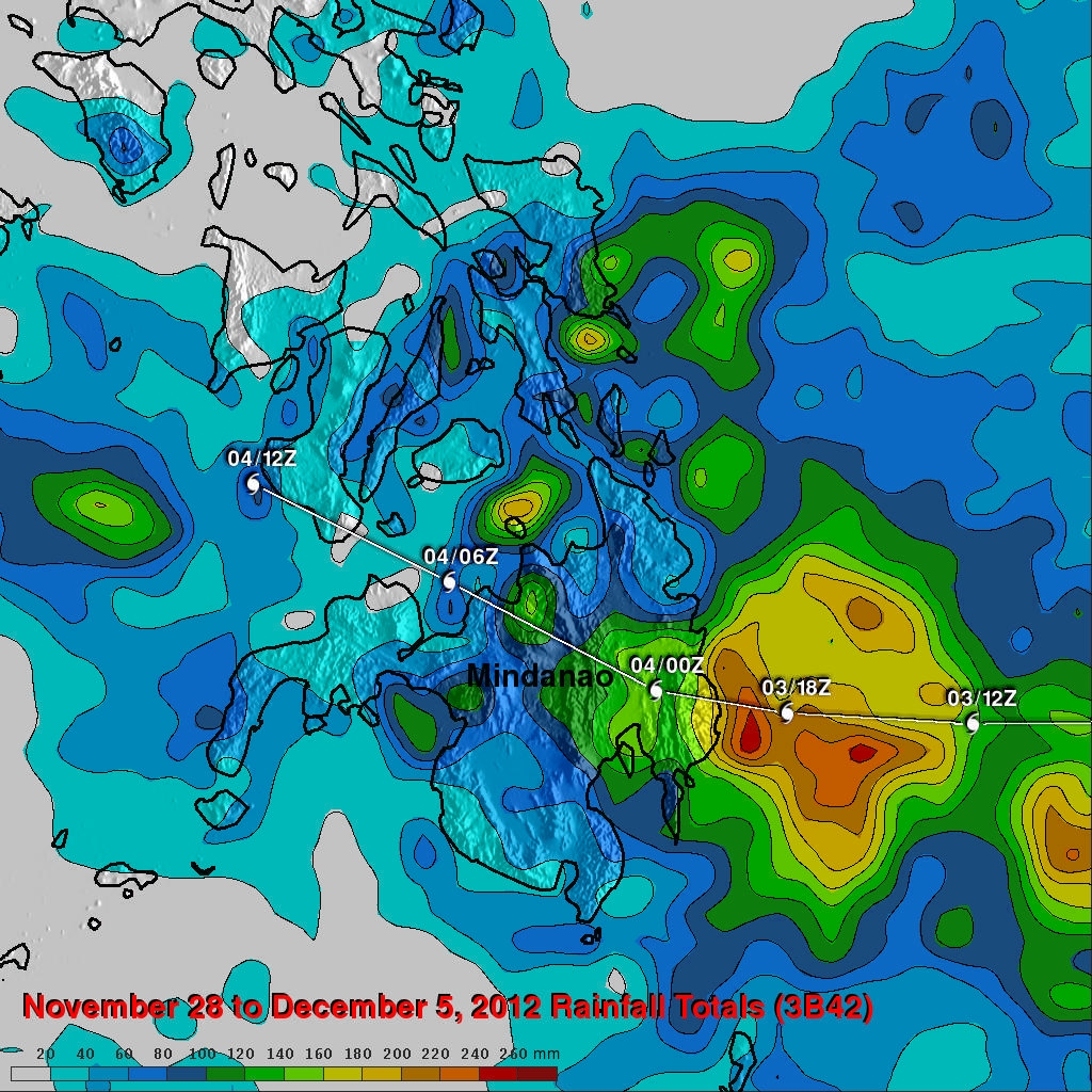
Typhoon Bopha's track is shown overlaid in white. This analysis shows that the heaviest rain, estimated at over 240 mm(~9.4 inches), was located near the coast of eastern Mindanao where the typhoon first hit the island. Rainfall totals of over 100mm (~3.9 inches) were common over a large area of eastern Mindanao. Bopha was moving relatively quickly (about 7.7166 ms) so total rainfall was lower and flooding was less than would have occurred with a slower moving typhoon.